The European Space Agency (ESA) recently ran an internal competition for its trainees to develop an app capable of making positioning fixes using only Galileo satellites. ESA challenged these young graduate and national trainees to develop smartphone apps to perform satellite navigation fixes solely with the use of Galileo satellites. Three teams developed apps in their spare time, presenting their results to a jury of experts from ESA, the European Global Navigation Satellite Systems Agency (GSA) and Google.
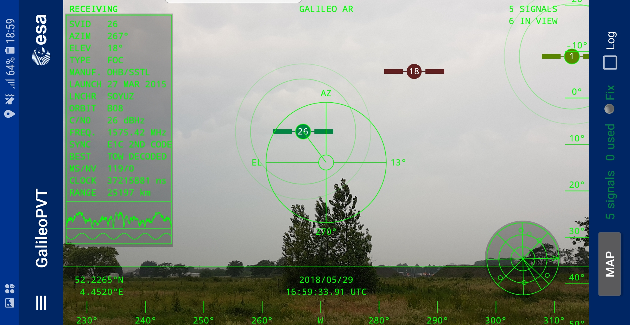
“As part of our support for the competition, we developed our own app on a voluntary basis to serve as a benchmark,” explained Paolo Crosta of ESA’s Radio Navigation Systems and Technology section, in a press release. “We included this augmented reality view, so users can ‘see’ the satellites their smartphone is using as they hold it up to the sky.”
The positioning calculations and assistance data functions for the app were developed by Crosta, with telecom engineer Tim Watterton contributing the main structure of the app, together with how it looks and its user interface.
“The satellites are overlaid in real time on the camera view in their predicted positions in the sky, based on ‘ephemeris’ information, assistance data that describes the current satellite orbits with high precision,” said Watterton (see image above).
“When a signal is being received, the satellite is shown in green, overlaying the predicted position. The satellite shown in red is one of the two placed in elongated orbits, but these satellites are expected to be used soon in the operational constellation. Satellites colored orange are transmitting, but the signal is not detected, which may be due to obstruction by terrain or buildings.”
Panning the phone around to position the crosshair over a green colored satellite adds additional information about it, such as its signal status, “pseudorange” (the uncorrected distance the signal has travelled to reach the receiver) plus the satellite’s manufacturer, and launch date among other items.
The reference app is now being tested with the hope of making it publicly available on the Android Play Store. The trainees are also testing their own apps following the competition with the goal of releasing them.
There are now 26 Galileo satellites in orbit, with the July 25 launch of four new satellites.


