 Prof. Jingnan Liu
A draft interface control document for China’s Compass (Beidou-2) GNSS system may be available by next year, according to remarks made at a September 30 presentation at the University of Nottingham (United Kingdom) by Jingnan Liu, principal scientist at the National GNSS Research Center of Wuhan University.
A draft interface control document for China’s Compass (Beidou-2) GNSS system may be available by next year, according to remarks made at a September 30 presentation at the University of Nottingham (United Kingdom) by Jingnan Liu, principal scientist at the National GNSS Research Center of Wuhan University.
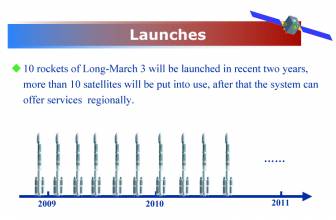
It appears that China is on course to complete a 12-satellite regional version of Compass by 2012, with funding assured through
2020 to complete and operate a full constellation.
The regional system will cover China and adjacent areas with 12 space vehicles (SVs): 5 in geostationary orbits (GEOs), 3 inclined geosynchronous orbit (IGSO) spacecraft, and four in middle earth orbit (MEO).
Thirty space vehicles (SVs) will comprise the full operational capability (FOC) system: 24 MEOs, 3 GEOs, and 3 IGSOs. The regional system presumably will include at least two of the GEOs launched as part of its experimental Beidou-1 system.
Liu, who also holds the prestigious rank of Academician in the Chinese Academy of Engineering, reported on results of monitoring of the Compass M-1 satellite launched April 14, 2007, conducted by the Wuhan center. The observations employed time synchronization measurements among ground reference stations augmented by two-way satellite time and frequency transfer techniques that used China’s SINO-1 GEO communications satellite.
Orbit determination comparisons (based on residuals) with Europe’s Galileo GIOVE-A satellite revealed an accuracy of an order of magnitude poorer than GIOVE-A — with residual areas of about 20 centimeters compared to 2 centimeters for the Galileo spacecraft. Moreover, Compass measurements experienced numerous carrier phase cycle slips — an average of 170 to 240 slips per arc cycle compared to fewer than 10 for GIOVE-A.
Liu attributed part of the poor results to the “weak geometry” of the five Compass tracking stations in China that allowed researchers to track less than 35 percent of the full arc of the satellite, which has an orbital inclination of 55.5 degrees and an altitude of 21,500 kilometers (13,330 miles).
The relatively poor quality of satellite equipment and receivers used for tracking Compass, compared to the combined GPS/Galileo receivers used to track — and provide time synchronization for — GIOVE-A, added to the problem. Furthermore, the availability of only one Compass spacecraft complicated the situation by preventing the use of differential data processing.
Satellite laser ranging to Compass M-1 show a radial orbit precision of better than one meter and a repeatability of about half a meter.
Liu identified the need to establish a larger tracking network both within and outside China to enable continuous, full-arc, tracking; combining M-1 measurements with GPS measurements while the global Compass system is being deployed in order to synchronize reference station clocks; and other efforts to improve orbit and satellite clock determination and prediction.


