Europe’s first two Galileo satellites have reached their final operating orbits, opening the way for activating and testing their navigation payloads.
Marking the formal end of their launch and early operations phase (LEOP), on November 3, control of the satellites was passed from the CNES French space agency center in Toulouse to the Galileo Control Center (GCC) in Oberpfaffenhofen, Germany.
By Inside GNSSRussia launched a Proton-M rocket carrying three GLONASS-M satellites from the Baikonur space center at November 4 after a 24-hour delay due to technical reasons, a spokesman for the Federal Space Agency Roscosmos said.
This was first launch of a Proton-M rocket with GLONASS satellites from Baikonur since a failed attempt last December. That led to the dismissal of several top officials in the space agency and industry and the appointment of Vladimir Popovkin to head the space agency.
Please.
Please. Please. Please.
Can we please talk about something besides LightSquared?
Not yet? You mean, they are still here?
And we have so many other GNSS-related topics that deserve comment:
Some peculiar cuts in civil GPS funds and GPS III budgets being proposed by congressional committees.
A re-examination — aka analysis of alternatives — of GPS and PNT options in general. Space weather and an impending solar max. Warrantless GPS-aided tracking before the Supreme Court.
By Inside GNSSQ: What effect does network size have on NRTK positioning?
A: Network real-time kinematic (NRTK) positioning is nowadays a very common practice, not only in academia but also in the professional world. In the last 10 years, several networks of continuous operating reference stations (CORSs) were created to support users. These networks offer real-time services for NRTK positioning, providing centimeter-level positioning accuracy with an average distance of 25–35 kilometers between the reference stations.
By Inside GNSSWith more testing on the horizon and a potentially alarming homeland security report about to be released, LightSquared’s efforts to begin work on its proposed wireless broadband service are stuck in the procedural mud.
The delays, which are never good for a commercial company, are piling up just as the firm’s coffers are thinning and need to be replenished with a new round of fund raising.
By Dee Ann DivisWorking Papers explore the technical and scientific themes that underpin GNSS programs and applications. This regular column is coordinated by Prof. Dr.-Ing. Günter Hein, head of Europe’s Galileo Operations and Evolution.

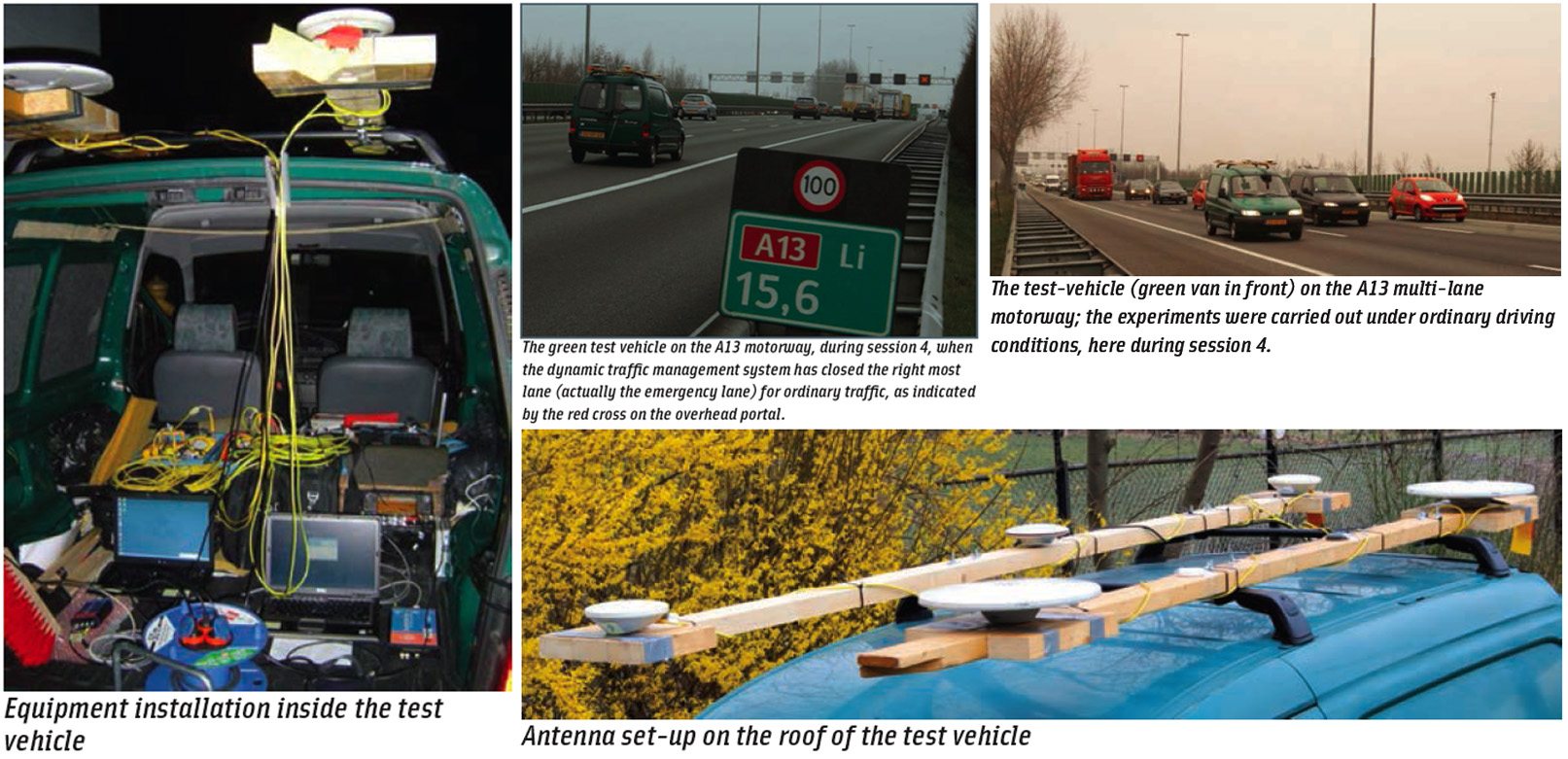
Next-generation car navigation may well require the ability to identify the lane in which a vehicle is operating on a motorway. This could support advanced driver assistance in general as well as the observation and study of driver behavior and traffic flow. Such road vehicle applications call for sub-meter positioning accuracy, often in real-time — all this preferably at low-cost.
By Inside GNSS