201005 May 2010 Archives - Inside GNSS - Global Navigation Satellite Systems Engineering, Policy, and Design

201005 May 2010

April 13, 2010

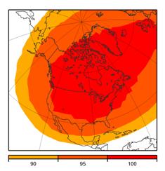
FAA Predicts Erosion of GPS WAAS Service Due to Intelsat GEO Failure

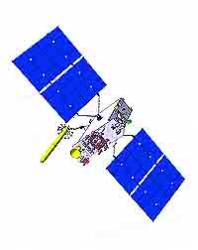
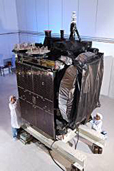
Galaxy 15 satellite under construction. Orbital Sciences photo

[updated April 13] Federal Aviation Administration (FAA) officials say that loss of control over an Intelsat geostationary (GEO) carrying a GPS Wide Area Augmentation System (WAAS) transponder could subject users in the National Air Space (NAS) to temporary outages for the rest of this year, beginning within the next two to four weeks as the GEO drifts out of a useable orbit.

Intelsat S.A. announced the anomaly in Galaxy 15 (G-15) on April 8. Although the communications services provided by G-15, located at 133 degrees west longitude (WL), have not been affected, according to Intelsat, the satellite apparently is not responding to commands by controllers. The anomalous condition began on April 3, according to the FAA.

The Luxembourg-based Intelsat is moving an older spacecraft (G-12) that serves as a backup for G-15 from its location at 123 degrees WL. However, G-12 does not have an L-band transponder, which is needed for WAAS transmissions.

Read More >

By Inside GNSS
April 10, 2010

U.S. Invites Comments for Easing GPS SVN49 Signal Anomaly

(This article first appeared in the March 31 Inside GNSS SIGNALS eNewsletter)

The GPS Wing is in the middle of a yearlong process designed to sort out the trade-offs among a set of at least nine options that may be undertaken to reduce the effects of a signal anomaly on the GPS satellite known as SVN49.

In a March 26 teleconference, the first of two scheduled to discuss the options, Lt. Col. James Lake, the wing’s deputy chief engineer, emphasized that some of the options could well improve the performance of some receivers while decreasing that of others.

He underlined the Air Force’s concern that receivers that don’t conform to the specification for GPS space segment/navigation user interfaces (IS-GPS-200) "greatly complicate the issue."

Read More >

By Inside GNSS

GNSS Opportunities Help Drive UK to Set Up National Space Agency

British Prime Minister Gordon Brown visits the Geospatial Building at the University of Nottingham. Photo courtesy of GRACE

(This article first appeared in the March 31 Inside GNSS SIGNALS eNewsletter)

Driven in part by a prestigious Space Innovation and Growth Strategy (Space IGS) report suggesting that the nation has lost both the best industrial work and the ability to influence programs such as Galileo, the United Kingdom will establish a new national space agency on April 1.

Read More >

By Inside GNSS
[uam_ad id="183541"]
April 9, 2010

Canada to Decommission DGPS System

CDGPS coverage map. NRCan image

The Canada-wide DGPS Service (CDGPS), a free GNSS augmentation system initiated by the Canadian Council on Geomatics (CCOG) in 2003, will be decommissioned by March 31, 2011, according to Gary Sawayama, the system’s general manager.

The CDGPS L-band broadcast has been carried by SkyTerra Communications Inc.’s MSAT communications satellites, which are expected to be replaced this year by the next-generation SkyTerra satellites. Significant new investment in infrastructural changes would be required to migrate to a new communication satellite.

Read More >

By Inside GNSS
IGM_e-news_subscribe