October 10, 2018
Topcon Technology Roadshow Provides Unique Interactive Opportunities for Attendees
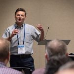
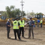
The Topcon Technology Roadshow rolled into Denver, Colorado for three days of technology-driven infrastructure demonstrations and hands-on operations. Co-hosted by GeoShack and Honnen Equipment Company at the Honnen Equipment facility in Commerce City, the event brought together more than 140 owners, project managers and operators from transportation agencies, contractor firms and surveying companies throughout the Denver metropolitan area.
By Inside GNSS