GNSS (all systems)

IFEN Launches NCS TITAN GNSS Simulator

IFEN has announced its new NCS TITAN multi-GNSS, multi-frequency and multi-RF output simulator.

With up to 256 channels and up to four RF outputs per chassis, the TITAN design avoids the extra complexity and cost of using additional signal generators or intricate architectures involv¬ing several hardware boxes, IFEN says, which improves reliability without compromising functionality.

Read More >

By Inside GNSS
September 16, 2016

Air Force Disposes of Long-Serving GPS IIA Satellite

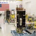
The U.S. Air Force’s 2nd Space Operations Squadron (2SOPS) at the 50th Space Wing, Schriever Air Force Base, Colorado, has moved the longest-serving GPS satellite, space vehicle number (SVN) 23, into a disposal orbit several hundred miles above the operational GPS constellation.

The satellite, which was launched on November 26, 1990, had a rough start, the Air Force said. After early-orbit operations and initial stabilization in December 1990, SVN 23’s solar array stopped working.

Read More >

By Inside GNSS
September 9, 2016

Changing the Rules

How do you win when you are really losing?

Play a different game, move the goalposts, change the rules.

For several years now, a series of would-be wireless broadband service providers have been attempting to convince the Federal Communications Commission (FCC) to repurpose radio frequency spectrum near the GPS L1 band.

Past efforts have failed because of the transmissions’ demonstrated harmful effects on GPS and other GNSS signals. Now a new contender is trying to gain FCC’s approval by changing the way that those effects are measured.

Read More >

By Inside GNSS
[uam_ad id="183541"]

GNSS Hotspots | September 2016

One of 12 magnetograms recorded at Greenwich Observatory during the Great Geomagnetic Storm of 1859
1996 soccer game in the Midwest, (Rick Dikeman image)
Nouméa ground station after the flood
A pencil and a coffee cup show the size of NASA’s teeny tiny PhoneSat
Bonus Hotspot: Naro Tartaruga AUV
Pacific lamprey spawning (photo by Jeremy Monroe, Fresh Waters Illustrated)
“Return of the Bucentaurn to the Molo on Ascension Day”, by (Giovanni Antonio Canal) Canaletto
The U.S. Naval Observatory Alternate Master Clock at 2nd Space Operations Squadron, Schriever AFB in Colorado. This photo was taken in January, 2006 during the addition of a leap second. The USNO master clocks control GPS timing. They are accurate to within one second every 20 million years (Satellites are so picky! Humans, on the other hand, just want to know if we’re too late for lunch) USAF photo by A1C Jason Ridder.
Detail of Compass/ BeiDou2 system diagram
Hotspot 6: Beluga A300 600ST

1. BREXIT
Harwell Didcot, United Kingdom

Read More >

By Inside GNSS
September 8, 2016

Single Versus Multiple

Dr. Kyle O’Keefe, University of Calgary

In the beginning, there was just one GNSS — the Global Positioning System — and just one fully available signal on the L1 frequency.

Eventually, some clever scientists discovered how to exploit certain characteristics of the encrypted L2 signal to come up with so-called codeless and semi-codeless techniques that enabled dual-frequency positioning. This hastened the development of user equipment that used the carrier phase of signals as well as the code to deliver high-precision results.

Read More >

By Inside GNSS
[uam_ad id="183541"]

The Particular Importance of Galileo E6C

Equations

The Galileo E6 signal is centered at 1278.75 MHz, and comprises three signals: an authorized signal (E6A, the publicly regulated service, PRS plus two civilian signals), a data component (E6B), and a pilot component (E6C). Both E6B and C are modulated using binary-phase shift keying (BPSK) code division multiple access (CDMA) memory codes, having lengths of 5,115 chips and chipping rates of 5.115 Mcps.

Read More >

By Inside GNSS

It’s Time for 3D Mapping–Aided GNSS

Figures 1-6

Real-time position accuracy, achievable in dense urban areas using low-cost equipment, is currently limited to tens of meters. If this could be improved to five meters or better, a host of potential applications would benefit. These include situation awareness of emergency, security and military personnel and vehicles; emergency caller location, mobile mapping, tracking vulnerable people and valuable assets, intelligent mobility, location-based services and charging, augmented reality; and enforcement of curfews, restraining orders and other court orders.

Read More >

By Inside GNSS

Geolocation Privacy

Reasonable Expectations of Privacy and a discussion of privacy in the United States typically begins with the Fourth Amendment of the U.S. Constitution, which provides that “[t]he right of the people to be secure in their persons, houses, papers, and effects, against unreasonable searches and seizures, shall not be violated.” In U.S. v Katz, the U.S. Supreme Court found that this Fourth Amendment protection created an individual’s constitutional right to privacy.

Read More >

By Ingo Baumann
August 29, 2016

2016 ITS World Congress: Intelligent Transportation Systems

Little Bourke Street, Melbourne

The 23rd world congress on intelligent transportation systems will take place at the Melbourne Convention and Exhibition Centre from October 10 through October 14, 2016. ITS Australia hosts this year’s event on behalf of ITS Asia Pacific, ITS America and ERTICO.

Melbourne is know for its intelligent transport system network that has become one of the best in the world. The conference organizers expect 7,000 international delegates and 300 exhibitors.

The them is "ITS-Enhancing Liveable Cities and Communities."

Read More >

By Inside GNSS
August 17, 2016

IWGRS2016: IEEE Workshop on Geoscience and Remote Sensing 2016

University Malaysia Putra – Engineering

IWUGR 2016 will take place at in Selangor, Malayia at the Universiti Putra Malaysia (UPM) in the Faculty of Engineering Auditorium on November 8 and 9.

IEEE Geoscience & Remote Sensing (GRSS) members will share knowledge and experience on recent developments and advancement in their fields, particularly on the topic of remote sensing for a sustainable environment.

The deadline for abstract submission is August 31.

Topics will include:
Geoscience and remote sensing technologies
Environmental and disaster monitoring

Read More >

By Inside GNSS
IGM_e-news_subscribe