B: Applications Archives - Page 142 of 151 - Inside GNSS - Global Navigation Satellite Systems Engineering, Policy, and Design

B: Applications

Trimble Announces New Precision Products, RolleiMetric Acquisition, and Saab JV


Trimble
has announced its new GNSS reference receiver — the Trimble NetR8 — for precise scientific and network infrastructure applications. The NetR8 reference receiver has 76 channels and supports GPS L1, L2, L2C and L5 signals as well as GLONASS L1/L2 signals.

Four additional channels are dedicated to tracking space-based augmentation systems
(SBAS), including Wide Area Augmentation System (WAAS) in North
America, European Geostationary Navigation Overlay System (EGNOS) in
Europe, Multi-functional Satellite Augmentation System (MSAS) in Japan,
Omnistar services and others.

Read More >

By Glen Gibbons
September 22, 2008

Galileo FOC Procurement ‘Short List’ Announced

Eleven contenders have been selected to build elements of the Galileo system — the so-called fully operational capability (FOC) infrastructure.
In a September 19 announcement, the European Commission (EC) and the European Space Agency (ESA) said they had chosen the candidates out of 21 applicants in the initial phase of the procurement procedure.

Following an invitation issued July 1, interested parties submitted a “Request to participate.” Candidates were short-listed on the basis of pre-defined selection and exclusion criteria.

Read More >

By Glen Gibbons
[uam_ad id="183541"]
September 8, 2008

Spread Spectrum Systems for GNSS and Wireless Communications

Spread Spectrum Systems for GNSS and Wireless Communications
By Jack K. Holmes
Artech House 2007. Hardcover. 874 pages
ISBN 978-1-59693-083-4

I will tell you up front that if you are a systems or design engineer involved in any field of spread spectrum technology, then you should invest in this new book. And you’ll want to read all 12 chapters with some “post-it” notes on hand to mark the pages containing figures and equations that you most likely will come back to review in more detail.

Most readers will probably not fully absorb this book during the first reading. Nonetheless, it helps to read through the entire presentation before attempting any in-depth understanding, because the author’s writing, equation formulation, and illustration style is conducive to a high level understanding of spread spectrum systems.

Author Jack K. Holmes is a well-known, highly published and long-time spread spectrum systems expert, instructor, and consultant in this field. He is Distinguished Engineer in the Communications and Network Architectures Subdivision of The Aerospace Corporation. One of the key roles of this part of the El Segundo, California–based company is its extensive GPS space segment, control segment, and ground (user equipment) segment systems engineering support for the U.S. Air Force’s GPS Wing.

This is not Dr. Holmes’ first book. I have owned a copy of the second edition of his Coherent Spread Spectrum Systems since 1990 and wish I had been aware of this latest gem sooner.

Like his first book, the new one is based almost entirely on analog (continuous time) theory and equations. It will help bridge the communications gap that inevitably exists between systems analysts and digital designers.

The discussion conveys only a high level of intuition regarding practical design synthesis of the modern hardware and real-time software required to actually build a system, because most spread spectrum systems today are entirely digital at the baseband level. Those skilled in such design will learn excellent trade-offs in their design choices and even how to extend their design skills to other communications systems.

However, readers who are unskilled in digital design probably will not pick up good design skills from this book. Readers skilled in analysis and simulations will be better able to analyze system performance predictions and critique design tradeoffs if the actual architecture is aptly communicated to them by the digital designers.

The author has formulated problems at the end of each chapter; so, he has apparently intended for it to be a graduate course level textbook.

Let’s take a closer look now at the contents of Holmes’ new book itself.

Hot Topic for GNSS Users
The new book encompasses the entire modern world of spread spectrum systems and then some. Chapter 1 provides a brief history of spread spectrum communications, followed by an introduction to narrowband signals (before they are spread), direct sequence with binary phase shift keying (BPSK) and with quadraphase phase shift keying (QPSK), minimum shift keying (MSK).

The discussion then proceeds to noncoherent (slow and fast) frequency hopped spread spectrum signals, and hybrid and time hopping spread spectrum signals. It concludes with a substantial introduction to orthogonal frequency division multiplexing (OFDM) and ultra-wideband (UWB) communications.

Even though OFDM and UWB are not classical spread spectrum systems, they certainly belong to the realm of modern communications signals. I bookmarked the section on Federal Communications Commission restrictions on UWB operations and the Part 15 emission limits. This is a hot topic to GNSS users worldwide because UWB has the potential of significantly raising the noise floor on these navigation signals.

Codes and Jamming
Chapter 2 deals rigorously with the math, formulation, and limitations of binary shift register codes. You will be able to design and analyze a large variety of pseudorandom noise (PRN) codes of various lengths and code sequences that are synthesized by this method.

Chapter 3 develops the effects of various types of jamming on the bit error rate (BER) performance for various types of spread spectrum modulations where no coding is provided to enhance the BER performance. Jammer types considered are wideband (barrage) noise jammers including pulse jammers and narrowband (partial band) noise jammers, plus continuous wave (tone), multi-tone, and matched spectral jammers.

Numerous chip modulation and data modulation combinations are analyzed for all types of jammers that effect BER. For most of the analysis cases, there is a BER plot provided with running parameters. For example, for pulsed jammer analysis, the running parameter is ρ (Rho), which represents the normalized time that the jammer is “on.” For examples, ρ = 1 is 100% and ρ = 0.4 is 40%.

Chapter 4 includes the beneficial effects of coding and interleaving to improve the BER and word error rate (WER) performance in the presence of jamming (or other effects such as attenuation that reduce the signal to noise ratio of the detected spread spectrum signal). First the various types of interleaving and coding techniques are defined and described mathematically as well as the decoding process.

In particular, the popular convolutional codes along with the Viterbi algorithm to decode the convolutional codes are presented and analyzed in depth. Both are now used in the data modulation and demodulation process of modernized GNSS signals. Here you will be dealing with some new terminology such as code rate, constraint length, maximum-likelihood processes, soft-decisions, zero filling, and tail-biting. These designs, especially the Viterbi decoder designs, are not only complicated but also memory- and throughput-intensive processes.

But this is the age where such marvelous innovations can be supported by modern digital technology. These analyses are not closed form, so they require computer simulations to determine the BER and WER performance. Some specific design examples have been simulated and plotted for the reader. Numerous other coding and decoding examples are also presented.

Carrier Tracking and Pseudonoise Code
Numerous carrier tracking loops for residual carrier signal tracking and suppressed carrier signal tracking are described and analyzed in Chapter 5. Several models of the phase locked loop (PLL) are analyzed (for dataless carrier applications). First, second and third order (analog) PLLs are then analyzed. Three types of frequency synthesis are described: digital, direct and indirect.

Various tracking techniques of BPSK signals are shown, including several Costas loops. Also described are Costas loop false lock protection levels and decision-directed Costas feedback loops. Very precise delta pseudorange measurements are obtained from PLLs in GNSS receivers operating with modernized dataless carriers.

Those containing data modulation (such as the present GPS signals) require the use of Costas (or Costas-like) PLLs. Costas PLLs lose some accuracy due to squaring loss caused by the presence of data modulation and about 6 dB of threshold performance in comparison to a pure PLL.

Multiphase carrier tracking loops, which are generalizations of the usual bi-phase Costas loops, are described in the context of quadraphase Costas loops. This chapter concludes with a brief treatment of (analog) frequency locked loops.

The acquisition of pseudonoise (PN) code in direct sequence receivers is covered in Chapter 6. PN acquisition is the initial alignment of the receiver’s replica PN code generator phase with that of the incoming PN code sequence. Numerous sequential code acquisition detector types are presented and analyzed, initially without the effects of Doppler and later with Doppler present.

In GNSS receivers, Doppler must always be considered, so the search process is simultaneously two-dimensional (code range dimension and carrier Doppler dimension). Section 6.4 provides a nice treatment of parallel code searching utilizing multiple correlators to speed up the code range search process. Section 6.5 is an extensive and thorough presentation of parallel frequency searching using fast Fourier transform (FFT) techniques to speed up the carrier Doppler search process.

Detection probabilities for BPSK and QPSK code modulation are analyzed assuming arbitrary Gaussian noise interference. BPSK detection probabilities are also derived assuming matched spectral and narrowband jamming interference (another place I bookmarked).

Section 6.6 is devoted to an optimum single correlator channel serial sweep search scheme pioneered by Holmes for the case where the time uncertainty is not uniformly distributed. Section 6.7 is devoted to sequential search detectors with variable integration times. Section 6.8 describes frequency domain search techniques using Fourier transform techniques. Section 6.9 provides an extensive treatment of matched filter search techniques.

Section 6.10 is a fairly comprehensive treatment of acquisition techniques for fast and slow frequency hopped signals with multiple frequency shift keying (MFSK) data modulation. Appendix 6A is devoted to signal flow graphs and discrete time invariant Markov processes.

Code Tracking
Direct sequence code tracking loops from which the pseudorange measurements are derived for a GNSS receiver are presented in Chapter 7. Numerous versions of non-coherent (in-phase) I and (quadraphase) Q, early-minus-late and dot product code tracking loops are described and analyzed for non-return-to-zero (NRZ) code modulation, including the effects of various types of interference.

The error performance is derived for a coherent code tracking loop (requiring the carrier tracking loop to be in phase lock) and three non-coherent code tracking loops (that will operate equally well with the carrier tracking loop in phase or frequency lock provided that both the I and Q signals are used in the code tracking loop).

Section 7.8 provides a fairly comprehensive description of multipath effects on both coherent and non-coherent code tracking loops. Other code tracking loop effects such as loss of lock and receiver blanking are presented.

Chapter 8 presents the performance of frequency hopped signals first without, then with data modulation. Chapter 9 describes multiple access methods for digital wireless cellular communications beginning with a brief history of cellular systems. First, second and third generation cellular communications systems multiple access techniques are presented and analyzed.

Chapter 10 is an introduction to fading channels. This chapter describes and analyzes numerous models for the various causes of loss of signal strength, including both outdoor and indoor models. Noteworthy is Section 10.12 that describes smart antennas, in particular adaptive array antennas.

Covert Communications
An introduction to the detection of covert communications systems is the focus of Chapter 11. Radiometers are the main focus for such covert signal detection, but three classes of detectors are described: those based on transform techniques (spectrum analyzer, compressive receiver, Bragg cell and FFT), energy detectors, (radiometers and channelized receivers), and rate line detectors (chip rate detectors and carrier frequency detectors). Both covert communications and interceptor techniques using these three classes of detectors are described and analyzed.

The performance of lock detectors that are used with all synchronization devices is covered in Chapter 12. The analytical approach used is to treat the lock detectors as absorbing Markov chains.

The theorems pertinent to lock detector theory are defined and proven up front. Some block diagram models for both suppressed and residual carrier tracking, PN tracking and frequency hopping are presented and discussed.

Overall, this book provides both a brief historical and a comprehensive theoretical plus analytical reference for spread spectrum and other modern communications systems. For those only interested in the GNSS applications, you will discover concepts and innovations presented in the wireless communications systems areas that should be in your GNSS conceptual and analytical tool kit (and vice versa). I rate it “5 Stars” as a comprehensive theoretical and analytical resource for all spread spectrum systems applications

By
August 28, 2008

GPS-Disciplined Frequency Standard

Suntsu Frequency Control, Inc. offers the SGPS2 series GPS- disciplined frequency and time standard. Combining a Furuno 16-channel GPS receiver and Suntsu’s own oven controlled crystal oscillator (OCXO) technology in a 2 x 2 x 1.25 inches (50.8 x 50.8 x 31.75 millimeters) package, the entire unit is mountable on printed circuit boards with a micro-miniature connector (MMCX) antenna connection on the side. The OCXO frequency is disciplined with timing signals from GPS satellites to maintain frequency accuracy to <1×10-12 in 24 hours.

Read More >

By Glen Gibbons
August 24, 2008

Agricultural and Energy Prices Driving GNSS Products and Services

From the perspective of consumers, the yearlong rise in commodity prices — from oil and natural gas to corn and wheat — has clouded the economic outlook. But for producers, including many GNSS manufacturers and service providers, those clouds have silver linings.

Recent financial reports from companies active in agricultural and natural resource markets bear this out. GNSS products used to guide and control equipment are in heavy demand as are real-time differential correction services, particularly those using global satellite-based systems.

Read More >

By Glen Gibbons
[uam_ad id="183541"]
August 14, 2008

Future Time

Existing GNSS systems use clocks based on microwave radio frequency (RF) standards operating at frequencies of up to 1010 Hz (10 GHz). This article examines the potential improvements and advantages of using clocks based on optical frequency standards, which have much higher natural frequencies of around 5 × 10¹⁴ Hz.

In general, high-precision clocks used to provide time in GNSS systems are based on three elements: a reference “frequency standard,” an oscillator, and a counter to count the oscillations.

Over the last two decades, the stability and accuracy of optical frequency standards based on trapped ions and atoms have improved to a point where their performance now exceeds that of microwave standards. (The articles by P. Gill listed in the Additional Resources section provide a good introduction to the principles and current state of optical clock design.)

The photograph above shows an example of a UK National Physical Laboratory (NPL) strontium ion end cap trap. By trapping a single strontium ion and laser cooling it to a few milli-Kelvin, the 674-nanometer “clock transition” can be interrogated using an ultra-narrow and stable (Hz-level) laser, which provides the optical oscillator.

The laser in these optical oscillators is stabilized by locking it to a special vibration-insensitive cavity made of ultra-low expansion (ULE) glass.

The last element of any clock is a counter. The development over the last decade of a special optical frequency measurement system known as an “optical frequency comb” has made possible the practical realization of optical clocks. Based on octave-spanning, femtosecond mode-locked lasers, such frequency combs can relate different stable optical frequencies with each other and with microwave frequencies with unprecedented relative frequency accuracy at the level of up to a part in 1019.

Ultimately, optical clocks will offer accuracies and stabilities at the level of a part in 1017 or better. Such devices are likely to find both terrestrial and space applications, in scientific and environmental fields as well as navigation. Eventually, the second will probably be redefined in terms of an optical reference, rather than the current standard of a 9.2 GHz cesium hyperfine transition.

. . .

Summary
Satellite clock prediction accuracy may be considerably improved with the emerging optical clock technology. To maximize the performance benefits, optical clocks should be placed onboard the satellites (and on ground to generate the system time).

Implementation of optical clocks to keep the system time could increase the accuracy of Galileo timing service (dissemination of UTC) and keep the UTC prediction function within the system. In this case, dependence on an external infrastructure such as the TSP may be reduced.

If other contributions to the error budget (mainly, the multipath) were reduced, we might anticipate further significant benefits to user positioning accuracy from improved clock technology, for instance, through exploitation of carrier phase techniques.

Placing better clocks on satellites will reduce the need for frequent updates, which will simplify the requirements on ground systems and also reduce costs. If update links were to fail for a significant amount of time, having very good clocks in the space segment would reduce the rate of degradation of the service to users on the ground.

Additional Resources
[1] Gill, P., “Optical frequency standards,” Metrologia, 42 S125, 2005
[2] Gill, P., and H. Margolis, “Optical clocks,” Physics World, May 2005

For the complete article, including figures and graphs, please download the PDF at the top of the page.

Issue Home

By

Follow the Sun: GNSS and Solar Car Racing

Continuum, the University of Michigan’s solar car that raced 2,400 miles propelled by the amount of power used by a hair dryer, started out in Texas and never surrendered the lead until they reached their goal in Alberta, Canada, on July 22.

Continuum, the University of Michigan’s solar car that raced 2,400 miles propelled by the amount of power used by a hair dryer, started out in Texas and never surrendered the lead until they reached their goal in Alberta, Canada, on July 22.

But when did the five-time winners of the North American Solar Challenge 2008 (NASC 2008) decide it was a sure thing?
“I knew we had won when we crossed the finish line,” said Alex Dowling, head strategist for the space-age car built and driven by engineering students through the hot middle of North America. “Until then, I worried about an unforeseeable problem, such as a vehicle system failing. I didn’t count it as a victory until we crossed the finish line.”

Maintaining an average speed of about 46 miles per hour, the ultra-modern Continuum covered the distance from Plano, Texas, to Calgary, Alberta, in 51 hours, 41 minutes and 53 seconds. (See the sidebar, “The Race,” for more about NASC 2008.)

Solar Power

What does it take to propel a 650-pound car and driver on such a serious road trip? Well, the more sun the better for the car’s solar cells, which convert the small amount of solar energy that makes it through the atmosphere directly into electrical energy.

Located on the vehicle’s upper surface, the car’s solar array consists of 2,700 triple-junction gallium-arsenide solar cells — the same type found on satellite solar panels. Any energy generated by the solar array that is not used to drive the vehicle is stored in Continuum’s lithium-polymer batteries.

But it took more than sunlight to make a winner out of Continuum. It took planning, strategy, and close coordination among the race car driver, escort vehicles, and the University of Michigan support team — assisted in all three task by GPS positioning.

The Cloud Strategy

The Michigan team emphasized the importance of accurate GPS and route information to their success. “This helped us plan ahead and save extra energy in the battery for those nasty hills,” they said on their 2008 race blog.

About two months before the race, the Michigan students drove the route and surveyed it at a 10 Hz sampling rate using two donated, 20-channel L1 survey GPS receivers and a commercial satellite-based differential GPS (DGPS) service. Along the route, data such as latitude, longitude, quality of the GPS signal and heading were collected and stored on a laptop computer. The team also marked locations of hills, for later use in planning vehicle speeds.

The GPS receiver was not integrated with the computer used to record the route information. Instead, the GPS receiver output route data over an RS-232 (serial) connection to the laptop. The team developed software that records the GPS data onto its hard drive.

The DGPS service provider specifies a 10-centimeter real-time accuracy using its corrections, but the Michigan team didn’t need to verify these for the survey. “We care more about precision than accuracy for our application,” said Dowling. “If everything is off by one meter in the same direction, it doesn’t matter. We care about the differences in elevation.”

After the route survey, the GPS information was postprocessed using the team-developed software. The team overlapped the data from the route survey, which included coordinates of stop signs, speed limit changes, and so forth, into a digital mapbase. To help navigation during the race, a team member wrote a custom program inside of the mapping software to show the upcoming hazards on the race route, along with turn-by-turn directions and the location of other caravan vehicles.

The postprocessed data was also stored and used by the computer to run simulations during the race. Indeed, no fewer than three strategists, including Dowling, were running route simulations during the race.

These people rode in a “chase” car, the support vehicle following about 20 feet behind Continuum. Variables that the simulations took into account included radiation levels, cross-winds, grade of the road, current state of the vehicle’s battery, and weight of the vehicle. Sometimes multiple simulations were run using the same program, but with different weather patterns as inputs.

Dowling primarily used two simulation/optimization programs, each with different optimization algorithms that took into account various factors (one had more detail than the other) and took different amounts of time to run.

“I knew the advantages and shortcomings of each simulation technique and was able to make an educated guess about which simulation was closest to reality,” he said. With that information and other undisclosed inputs, Dowling was able to recommend a vehicle speed conducive to making the most efficient use of the available sunlight and stored energy in the battery.

The simulation and optimization software took into account the exact location of the vehicle.

Traveling the right speed at all times was a key to winning the race. Continuum couldn’t produce enough energy to run the entire distance at the speed limit, and the team faced a hard choice. If the car traveled fast under clouds, it risked drawing down too much battery power. On the other hand, running under clouds at the speed limit could help win the race and would move the car into sunny weather sooner, where it could gather more energy.

During the race, the GPS survey receiver was installed on the chase cars, but not on Continuum because it would have been extra weight on the vehicle. (It’s a race car, after all.)

The receiver was configured to output at 10 Hz and used a one-meter DGPS correction service during the race. The motor on Continuum contains a Hall Effect sensor that measured the speed of the vehicle.

Other support vehicles had simpler GPS navigation units on them. These units were used in conjunction with the navigation software described earlier to share the location of support vehicles with each other. This position data was transferred over the Internet using cellular Internet cards.

With the benefit of the GPS route survey, at any point in the race the team knew what terrain lay ahead of the race car and could budget Continuum’s energy better.

Dowling believes the Michigan strategy was superior to the other teams. “Lots of times we drove fast to get out of the clouds and were able to spend more time driving in the sun. Most of the other teams drove slowly in the clouds and were stuck under them for a longer period of time.”

Lead, Scout, Weather, and Chase

During the race, Continuum enjoyed the support of four escort vehicles. Running about a half-hour in front of the Michigan team, meteorology student Brad Charboneau transmitted weather forecasts from “Weather.” About 10 miles in front of Continuum, ”Scout” carried two relief solar car drivers and cleared the road of any foreign objects, including road kill, which might slow down or disable the ground-hugging solar car.

“Lead,” the vehicle carrying support engineering students, ran just in front of Continuum. Directly behind the solar car, “Chase” carried the three strategists, Michigan’s race manager Jeff Ferman, crew chief Doug Lambert, and an additional engineer as driver.

The team used two main modes of communication: radio or text-style messaging. The solar car driver had a radio for communications with the Lead and Chase vehicles. Lead and Chase could send text messages that appeared on a driver display. The driver then answered questions using “yes” and “no” buttons on the steering wheel.

Ferman said the Chase and Lead cars shared the same telemetry information, including speed of the solar vehicle, voltages and currents, and the battery pack reading. “Any power consumptions that we can read, we do read,” he said.

Under the Hood

Continuum runs on three wheels, like a large tricycle. The front wheel steers and drives the car.

The driver adjusts the vehicle’s speed using a throttle paddle (potentiometer) on the steering wheel — a small lever that can be depressed with the thumb. The vehicle’s electrical system processes this signal and adjusts the output of the vehicle’s motor according, which causes the vehicle to either accelerate, decelerate or maintain speed.

The team’s strategists also have the ability of sending a cruise-control command to the vehicle. If the driver accepts the new cruise control speed, the vehicle automatically adjusts. Continuum’s motor is also capable of regenerative braking. In addition, the vehicle has custom disk brakes.

During the race, teams drove from 8 a.m. until 6 p.m. each day over a 10-day period. In the morning and evening, they were permitted to charge their main battery using only their solar array. Continuum was very competitive in almost every area, said Dowling, with an efficient battery pack and electric motor, a powerful solar array, and an aerodynamic body.

The car had already competed in the World Solar Challenge held during the summer of 2007 in Australia. It had finished seventh, despite a serious accident on the first day.

“Our team spent the past year perfecting the car while other teams were still building their vehicles,“ Dowling said, “So, Continuum was very reliable, and we spent only minimal time on the side of the road during the race.”

About the Race

Fifteen solar cars from universities in the U.S., Canada, and Germany completed in North American Solar Challenge (NASC) 2008, sponsored this year by Toyota, the DNA Group, and Crowder College Missouri Alternative and Renewable Energy Technology (MARET) Center.

The 18-year-old event is designed to inspire young people to pursue careers in science and engineering. And with each race, the solar cars travel faster and further with greater reliability.

NASC’s predecessors, the American Solar Challenge and Sunrayce, were underwritten by the U.S. Department of Energy until funding was cut in 2005. The race generally has been held every two years since 1990.

This year, the race was run in five stages over the course of 10 days. The University of Michigan, whose team is profiled here, is a seasoned veteran of the competition. The 2008 winner, Continuum, is their ninth solar-powered vehicle. It beat the second-place entry — Ra 7 from Principia College in Illinois — by 10 hours.

By
August 11, 2008

Europe Launches Full Galileo Procurement

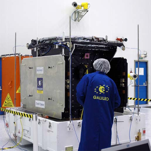
The European Commission (EC) — with the support of the European Space Agency (ESA) — has launched the procurement process for Galileo with an invitation to companies to submit requests for participation as prime contractors for six work packages (WPs) valued at €2.145 billion (US$3.39 billion).

The deadline for replying to the invitation is August 7.

In a resolution on space and security passed by a large margin on July 10, the European Parliament endorsed the use of Galileo, particularly the public regulated service or PRS, as necessary for autonomous operations under the European Security and Defense Policy — perhaps the most forthright statement of support for prospective use of the civil-controlled GNSS system for military purposes.

In the meantime, Galileo program scientists and independent researchers continue to track and test the signals being transmitted by the latest Galileo experimental satellite, GIOVE-B. Articles in the forthcoming September/October issue of Inside GNSS will discuss the latest results of in-orbit tests of GIOVE-A and –B, drawing in part on data collected using a 25-meter dish antenna at Chilbolton in the United Kingdom.

Two Delft University of Technology faculty members, Christian Tiberius and Hans van der Marel, working with engineers at Belgian GNSS receiver manufacturer Septentrio, have reported successful calculation of Galileo-only double-difference carrier phase integer ambiguity measurements using L1 Open Service signals from the two GIOVE spacecraft. That work will also be described in an article in the September/October issue [of Inside GNSS magazine].

ESA will act as the Galileo procurement and design agent for the EC, which is the program manager and contracting authority of the publicly financed project. The process will follow a distinctively European process that includes a “competitive dialog” between ESA and the prospective prime contractors.

Under the current schedule, within seven weeks following the RTP deadline ESA will approve a short list of companies that will be invited to submit preliminary proposals on the work packages and take part in a dialog. After vetting during an intermediate dialog phase, selected companies will offer “refined proposals.”

The new procurement plan seems to relegate non-European companies to subcontract status. But some U.S. companies would like to be able to compete for the lead contracts for the Galileo satellites, for instance.

However, the tender guidelines limit prime contracts in the Galileo FOC procurement to “natural or legal persons established in one of the Member States of the European Union.” Moreover, subcontractors providing goods or services related to EU or national security must also be from the EU. In “exceptional circumstances,” ESA may authorize the use of non-EU subcontractors.

The competitive dialog phase is projected to take 15–30 weeks at the end of which successful companies will be invited to submit best and final offers (BAFOs) and supporting documentation. Contract awards would follow within three weeks, according to the current plan; however, the EC and ESA emphasize that the proposed timeline is “purely indicative” and may be shortened or lengthened.

Individually, the following estimated values have been earmarked for the six work packages:
• WP 1: System Support: €120 million
• WP2: Ground Mission Segment: €270 million
• WP 3: Ground Control Segment: €45 million
• WP 4: Space Segment (satellites): €840 million
• WP 5: Launch Services: €700 million
• WP 6: Operations €170 million

The overall program objective for Galileo is the deployment, by 2013, of a full operational capability (FOC) GNSS system comprising 30 satellites and ground facilities. The FOC Galileo system will provide five main services: Open Service, the Safety of Life Service, the Commercial Service, the Public Regulated Service (PRS), and the Search and Rescue Service.

Wanted: GNSS Advisor
. Earlier, the EC Directorate-General for Energy and Transport (DG-TREN) issued an invitation to tender (ITT) for an advisor on the European GNSS program.

With a one-year term renewable up to three times, the contract will be designed to provide a pool of experts and organizations for review and counsel on administrative, financial, strategic and technical matters.

By
July 30, 2008

Lost in the Noise: The Need for Longterm Infrastructure Development

You know how people talk louder when asking something of a person who doesn’t speak their language? (As if the failure to communicate is a simply matter of volume and not frequency or modulation.)

So, here we are in the GNSS world: a community that depends on radio waves so faint they might as well be Atlantic Ocean breakers rippling up on the Florida beach when a Daytona car race is roaring in the background.

Lost in the noise.

From time to time, that has stood in as a metaphor for the U.S. GPS program, and it could be a permanent description of the state of our national public infrastructure — deferred maintenance.

Inadequate investment is nothing less than not-so-benign neglect. The road to second-class status.

Designing an industrial policy and restoring the U.S. industrial base isn’t a short-term project. If we think of longitudinal time as the RF spectrum of history, infrastructure development requires lots of bandwidth. It took us a decade to agree on launching a GPS III program and it’ll take us another decade to roll it out. Infrastructure is implicitly a long-lead item, and driving the process forward requires sustained human will, expertise, and vision.

Recently, I asked Craig Cooning, vice president and general manager of Boeing Space and Intelligence Systems, about the state of public investment and planning to maintain an industrial base. Cooning mentioned the Office of the Deputy Under Secretary of Defense for Industrial Policy (ODUSD-IP) and observed that he hadn’t seen much involvement by that office lately.

“I don’t know what accounts for that,” Cooning added, “but I think it’s something to turn the gain up on.”

The ODUSD-IP mission “is to sustain an environment that ensures the industrial base on which the De-partment of Defense (DoD) depends is reliable, cost-effective, and sufficient to meet DoD requirements.” An admirable national goal, especially if we broaden the focus to the wider economy.

We tend to think of infrastructure as bricks and mortar, steel and concrete, satellites and ground control. But it also includes social systems such as education and health care. If we neglect to teach and heal, we lose national capability just as surely as when a power line falls down or GPS goes off the air.

Good infrastructure pays back an investment many times over, but infrastructure itself isn’t free and, as Europe discovered with the Galileo program, it doesn’t really fit within the usual financial planning timelines of private industry.

After Boeing lost its bid for the GPS III contract, the company laid off around 700 development engineers — not to be confused with production engineers. Both kinds of engineering skills are needed to produce a complex system such as GNSS. But development engineers come up with the imaginative designs, challenge the paradigms, take the innovations for a spin around the block.

They must create something from nothing and, when a contract eludes them, that’s what their employers are often left with — nothing.

And there’s only so long a company can stay in business earning nothing . . .

This is not, however, a defense of bailouts or a plea for larger outlays for military programs. It is a plea for more comprehensive planning, good judgment in choosing among alternatives, prudent investment, and staying the course in matters of sustaining the U.S. industrial base.

Given this situation, the long-running dialog on creating a rational and comprehensive National Positioning, Navigation, and Timing (PNT) Architecture with a 20-year horizon comes as a welcome relief.

Of course, it remains to be seen whether the overarching and somewhat abstract vision can be converted into programs, timelines, and budgets — in short, into a PNT industrial plan and policy. PNT systems are not, after all, just technologies; they are also political turfs, and totems, and talismans.

But the intention is good and the experience just a foretaste of what would be in store if the United States actually got serious about creating an industrial policy.

By
July 29, 2008

NXP/STMicroelectronics JV Launches

ST-NXP Wireless, a new company bringing together key wireless operations of STMicroelectronics and NXP, will begin operations August 2 following completion of a deal announced earlier this year.

Owning thousands of communication and multimedia patents, the new joint venture will bring key technologies for UMTS (Universal Mobile Telecommunication System) and for the emerging TD-SCDMA standard, as well as other cellular, multimedia and connectivity capabilities — including WiFi, Bluetooth, GPS, FM radio, USB, and UWB (ultra-wideband).

Read More >

By Glen Gibbons
IGM_e-news_subscribe