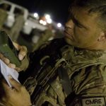
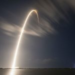
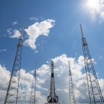
Aerospace and Defense

U2: BeiDou Is My Co-pilot

According to a statement by the head of U.S. Air Force Air Combat Command, pilots of the elite U-2 spy plane wear watches that receive foreign GNSS signals and provide backup navigation when GPS is jammed.

“My U-2 guys fly with a watch now that ties into GPS, but also BeiDou and the Russian [GLONASS] system and the European [Galileo] system so that if somebody jams GPS, they still get the others,” said Gen. James “Mike” Holmes on March 4 at the McAleese Defense Programs Conference in Washington.

The Lockheed U-2, nicknamed “Dragon Lady,” is a single-jet engine, ultra-high altitude (70,000 feet, 21,300 meters) reconnaissance aircraft. It gathers intelligence with a variety of sensors. The U-2 is one of very few aircraft that have served the Air Force for more than 50 years, a select group that also includes the B-52 long-range bomber. The latest model, the U-2S, had a technical upgrade in 2012. [Dragon Lady photo above, courtesy Lockheed.]

Gen. Holmes did not name the watch manufacturer.

In February 2018, Garmin announced that its D2 Charlie aviator watch had been selected by the Air Force  for use by the pilots of the Lockheed U-2 aircraft. “The high-sensitivity WAAS GPS-enabled D2 Charlie aviator watch incorporates global navigation capability, rich and colorful moving maps and more, providing pilots in the USAF with an exclusive, back-up navigation timepiece in the cockpit. . . . The D2 Charlie aviator watch will be an integral and functional part of the U-2 pilot’s toolkit.”

According to the press release, Garmin expected the United States Air Force to take delivery of more than 100 D2 Charlies.

Among the sensors mentioned on Garmin’s spec sheet for the watch are GPS, GLONASS, a heart rate monitor, barometric altimeter, compass, accelerometer and thermometer. BeiDou is not listed.

However, in an annual report filed with the Securities and Exchange Commission, the company stated: “Garmin utilizes a variety of other global navigation satellite systems (GNSS) including, but not limited to . . . .The BeiDou Navigation Satellite System (BDS), a Chinese satellite navigation system that is expected to have 35 operating satellites in orbit by 2020 and will provide global coverage.”

Charlie
Garmin’s D2 Charlie watch, shown here with Weather radar overlay feature. Photo: Garmin

D2 Charlie has a sapphire scratch-resistant crystal lens and a diamond-like carbon (DLC) coated titanium bezel. A sunlight-readable, high-resolution color display with LED backlight on the watch face allows pilots to view data in most lighting conditions in the cockpit. It offers up to 20 hours of battery life in GPS mode and up to 12 days in smartwatch mode. It comes with a leather wristband and a sporty silicone band.

By Inside GNSS
March 6, 2020

Rescue Satellite Makes Space Navigation History

In late February, Northrop Grumman’s Mission Extension Vehicle MEV-1 autonomously docked with another satellite in geostationary orbit in space, making navigation history.  It simultaneously took the next step in satellite operation by extending Intelsat 901’s lifetime beyond its original plan. The so-called “rescue satellite,” built by Northrop Grumman subsidiary Space Logistics, used a combination of traditional ranging, optical orbit determination from ground, and on-board sensors (visible, infrared, and LiDAR)  for relative navigation in space to make its ultra-precise rendezvous 35,786 km above Earth.

The successful operation means a potential sea change in satellite operation: their lifetimes can be extended, and defunct satellites can be moved to safer orbit even after their fuel supplies are exhausted.

The complex series of maneuvers to bring the two satellites together began with an October 2019 launch of the MEV-1. Northrop Grumman controllers undertook a series of engine burns to raise MEV-1’s orbit from its highly elliptical geostationary transfer orbit up to a circular orbit 300 km above the geosynchronous belt. Shortly thereafter, Intelsat decommissioned its satellite 901, and it used the last of its propellant to move into the GEO graveyard orbit.

MEV-1 approached.

For 19 days, MEV-1 advanced upon and withdrew from Intelsat 901, calibrating its navigation sensors: optical cameras, infrared cameras and side-scanning LiDAR to orient and position itself relative to Intelsat 901.

5
Images courtesy Northrop Grumman.

For the final delicate and very precise maneuver, on February 25 MEV-1 autonomously flew to 20-meter distance, pausing before resuming travel to the critical 1-meter docking position. It autonomously extended a docking probe, engaging an engine nozzle aboard Intelsat 901. A nozzle, by the way, that was never designed for docking purposes.

MEV-1 then extended a group of internal grippers to anchor the two satellites together.

The satellite duo are now jointly performing stack on-orbit checkouts. Later this month, MEV-1 will relocating the two of them to a GEO spot over the central Atlantic, where Intelsat 901 will take over services for another Intelsat satellite, providing C-band service in the Americas, Europe, and Africa.

MEV-1 will then, like the Lone Ranger, bid farewell to Intelsat 901 and move on to a new mission.

By Inside GNSS
[uam_ad id="183541"]
March 3, 2020

Air and Space Forces Want $100s of Millions More for GPS-related Priority Projects

When the White House submits its budget request for the Department of Defense to Congress every year, that is not the final word. The different military services also send Congress their unfunded priority lists, which detail the projects the White House chose to forego but, the services hope, Congress will add back in. This year several of those priorities are GPS-related.

Read More >

By Dee Ann Divis
[uam_ad id="183541"]
February 5, 2020

European Space Agency Looks at 2020

European Space Agency (ESA) top brass welcomed journalists to the Agency’s headquarters in Paris for its annual New Year’s press launch. On hand was the Director General as well as ESA’s Galileo guru Paul Verhoef, who spoke one-on-one with Inside GNSS.

Read More >

By Peter Gutierrez

Details Emerge On Ligado Decision Delay

The chairman of the Federal Communications Commission (FCC) told two U.S. Senators in January that his agency could not complete a decision on Ligado Network’s license modification by the end of 2019 because of a late-in-the-year response from a key federal agency.

Read More >

By Dee Ann Divis
February 3, 2020

Characterizing GNSS Interference from Low-Earth Orbit

2017 and 2018 saw unprecedented GNSS interference activity, from the eastern Mediterranean to Norway and Finland. Syria emerged as a testbed for electronic warfare capabilities. In April 2018, General Raymond Thomas, commander, U.S. Special Operations Command, referred to the region as “the most aggressive electronic warfare environment on the planet.”

Read More >

By Inside GNSS
1 26 27 28 29 30 67
IGM_e-news_subscribe