October 1, 2009
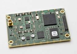
NovAtel OEMStar
NovAtel Launches GPS / GLONASS Products at ION Conference
NovAtel OEMStarNovAtel Inc. rolled out a series of new products and a firmware upgrade at the Institute of Navigation’s ION GNSS 2009 conference held September 22-25 in Savannah, Georgia, USA.
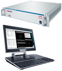
The Calgary, Alberta, Canada–based GNSS manufacturer announced the launch of their new single-frequency GNSS receiver, OEMStar. The low-cost, 14-channel, L1 receiver measures 46 x 71 millimeters and consumes just 750 milliwatts of power when tracking both GPS and GLONASS signals.
By Inside GNSS