April 23, 2015
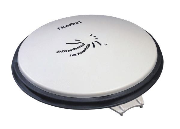
NovAtel GPS-704-WB antenna
Novatel Launches Multi-GNSS Wideband Antenna
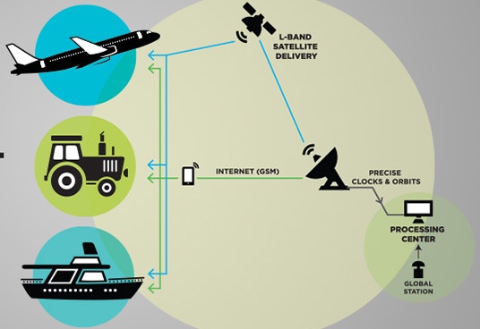
NovAtel GPS-704-WB antennaNovAtel Inc. today (April 23, 2015) launched the GPS-704-WB antenna, a wideband antenna that supports L-band as well as the frequencies of all current GNSS constellations (GPS, GLONASS, Galileo, and BeiDou), including B3 and E6 signals. Customers can use this antenna for GPS-only or multi-constellation applications, providing excellent flexibility for application developers, according to the company.
By Inside GNSS