September 16, 2015
UNAVCO Names Septentrio as Preferred Vendor for GNSS Reference Stations
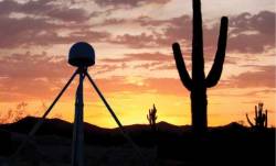
UNAVCO has announced the selection of Septentrio to be the preferred vendor of next-generation GNSS reference stations for the Geodesy Advancing Geosciences and EarthScope (GAGE) Facility. The preferred vendor status is valid through the duration of the GAGE Facility Cooperative Agreement with the National Science Foundation (NSF).