GPS

April 10, 2017

Debate Continues on ATC Privatization 

Discussions continue on the pros and cons surrounding the possible privatization of the nation’s Air Traffic Control (ATC), with opponents sharing concerns and a proposal by President Trump aimed at looking into taking the air operations duties away from the Federal Aviation Administration (FAA).

Read More >

By Inside GNSS
April 9, 2017

GNSS Hotspots | April 2017

One of 12 magnetograms recorded at Greenwich Observatory during the Great Geomagnetic Storm of 1859
1996 soccer game in the Midwest, (Rick Dikeman image)
Nouméa ground station after the flood
A pencil and a coffee cup show the size of NASA’s teeny tiny PhoneSat
Bonus Hotspot: Naro Tartaruga AUV
Pacific lamprey spawning (photo by Jeremy Monroe, Fresh Waters Illustrated)
“Return of the Bucentaurn to the Molo on Ascension Day”, by (Giovanni Antonio Canal) Canaletto
The U.S. Naval Observatory Alternate Master Clock at 2nd Space Operations Squadron, Schriever AFB in Colorado. This photo was taken in January, 2006 during the addition of a leap second. The USNO master clocks control GPS timing. They are accurate to within one second every 20 million years (Satellites are so picky! Humans, on the other hand, just want to know if we’re too late for lunch) USAF photo by A1C Jason Ridder.
Detail of Compass/ BeiDou2 system diagram
Hotspot 6: Beluga A300 600ST

1. ANTARCTIC OASIS
Antarctic Peninsula

Read More >

By Inside GNSS
April 5, 2017

Automated Vehicles Symposium 2017

A view of San Francisco from the Municipal Pier. Wikimedia Commons photo by Blake Everett.

The Automated Vehicles Symposium 2017 convenes industry, government, and academia from around the world to address complex technology, operations, and policy issues. With a mission to inform and engage, to support progress towards safe, automated mobility, the symposium will take place from July 11-13 in San Francisco, with Ancillary Meetings July 10 and 14. Abstracts for the poster sessions are due by Friday, April 7, 2017.

Read More >

By Inside GNSS
[uam_ad id="183541"]
April 4, 2017

NovAtel Releases Oceanix Nearshore GNSS Correction Service for Marine Applications

NovAtel today unveiled its Oceanix Nearshore correction service at Ocean Business 2017 in Southampton, UK.

Oceanix Nearshore, a subscription-based GNSS correction service for Precise Point Positioning (PPP), provides exceptionally reliable sub-decimeter positioning for marine applications such as dredging, hydrographic survey, mapping and coastal patrolling, according to NovAtel.

With a robust infrastructure, Oceanix precise corrections data is generated utilizing a network of more than 80 strategically located GNSS reference stations globally.

Read More >

By Inside GNSS
April 3, 2017

SBG Systems to Unveil Qinertia INS/GNSS Post-Processing Software at Ocean Business

Qinertia INS/GNSS post-processing software. Photo source: SBG Systems.

Rueil-Malmaison, France-based SBG Systems will unveil Qinertia, its in-house post-processing software, at the Ocean Business show, April 4-6 at Southampton, U.K.

After the survey, this full-feature software is designed to give access to offline real-time kinematic (RTK) corrections, and process inertial and GNSS raw data to further enhance accuracy and secure the survey.

Read More >

By Inside GNSS
April 2, 2017

Is That All There Is to GPS?

Looking over the initial budget of the Trump administration, we can safely say that the president and his timorous collaborators on Capitol Hill have a maximalist concept of providing for “the common defense” and a minimalist one for promoting “the general welfare,” two of the six missions enshrined in the preamble of the U.S. Constitution.

Read More >

By Inside GNSS
[uam_ad id="183541"]
April 1, 2017

Ligado Test Results Roll In

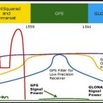
Figures and Charts

The GPS community and Virginia-based Ligado are weighing new and upcoming test results as the standoff over interference with satellite navigation services enters its seventh year.

The dispute centers on the company’s now modified proposal to build a terrestrial wireless network supported by frequencies originally allocated for satellites. Though there had been a move some years earlier to augment the satellite services with ground stations the company’s first plan envisioned some 30,000 high-powered ground terminals.

Read More >

By Dee Ann Divis

GNSS for ERTMS Train Localization

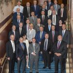
Demo Test in Italy on Cagliari – Decimomannu line – February 24, 2017. From left: Josef Doppelbauer (Executive director of ERA – European Union Agency for Rail), Maurizio Gentile (Chief Executive Officer of RFI – Rete Ferroviaria Italiana), Jean-Pierre Loubinoux (Director General of UIC – the worldwide professional association representing the railway sector and promoting rail transport), Carlo des Dorides (Executive director of GSA).

Read More >

By Inside GNSS
March 31, 2017

Swift Navigation, Carnegie Robotics Partnership to Yield High-Precision GNSS, Inertial Technology Products

Swift Navigation CTO Fergus Noble, left, and Carnegie Robotics CTO Chris Osterwood, right. Photo source: Swift Navigation.

A partnership between Swift Navigation and Carnegie Robotics announced this week is expected to yield a line of navigation products for autonomous vehicles, outdoor robotics and machine control.

San Francisco-based Swift Navigation is a startup building centimeter-accurate GPS technology designed to power a world of autonomous vehicles, while Carnegie Robotics, located in Pittsburgh, Pennsylvania, provides advanced robotics sensors and platforms for defense, agriculture, mining, infrastructure and energy applications.

Read More >

By Inside GNSS
March 30, 2017

Orolia’s Satellite-Based Alternative PNT Solution Demonstrates a Resilient Timing Solution

Orolia recently announced successful synchronization in multiple indoor locations. Photo source: Oriola.

Rochester, New York-based Orolia recently announced (March 22) that in several indoor environments in the field, it has successfully synchronized a Spectracom SecureSync high precision time server with the new Iridium Satelles Satellite Time & Location (STL) time synchronization signal powered by Iridium satellites.

Read More >

By Inside GNSS
1 42 43 44 45 46 142
IGM_e-news_subscribe