Once widely written off as another victim of the economic and political disarray following the collapse of the USSR, Russia’s GLObal NAvigation Satellite System (GLONASS) has arguably demonstrated the most stability of the world’s three GNSS programs in recent years.
Once widely written off as another victim of the economic and political disarray following the collapse of the USSR, Russia’s GLObal NAvigation Satellite System (GLONASS) has arguably demonstrated the most stability of the world’s three GNSS programs in recent years.
GLONASS followed the Global Positioning System into space with its first satellite launch on October 12, 1982, 4½ years behind the first GPS satellite went up. After reaching a high point in 1996 with more than two dozen operating satellites in orbit, GLONASS dwindled over the next five years to a nadir of seven operational satellites.
Strapped for cash and expecting a greater role in Europe’s Galileo project, Russia allowed paying commercial payloads from foreign customers to get in line ahead of GLONASS at its launch facilities. A dispute with newly independent Kazakhstan over maintenance, operation, and funding of the Baikonur launch facility further complicated the picture. Meanwhile, the relatively short design life of the spacecraft (three years compared to 7½ years for GPS) contributed to a rapid decline in operational satellites.
In 2001, a new Russian government under President Vladimir Putin reassessed its commitment to space-based positioning, navigation, and timing (PNT), and refashioned its development timeline to more sustainable dimensions. An August 21, 2001, decision committed the government to a 2002-2011 program to rebuild and modernize GLONASS.
A schedule of annual launches since then has doubled the constellation to 13 operational satellites. As a result, since 2001 the gap in worldwide navigation with GLONASS declined from 14 to 2 hours as of November with coverage 98 percent of the time over Russia, according to Sergey Revnivykh, an official with Roscosmos’ Satellite Navigation Department at the Mission Control Center of the Central Research Institute of Machine Building.
Picking Up the Pace
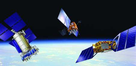
On December 25, Russia placed three more spacecraft into orbit and brought the system within striking distance of an 18-satellite constellation, which should be in place late next year with all satellites in service by early 2008. Under the current plan, the frequency of launches would increase over the next two years to provide a 24-satellite constellation by 2010–11.
The day after the December 25 launch, however, Putin expressed support for accelerating the GLONASS effort. According to the Russian Information Agency Novosti, Putin told government members, “The GLONASS system should be created before 2008, as it was originally planned. We have the possibility. Let us see what can be done in 2006-2007.”
RIA Novosti subsequently quoted Anatoly Perminov, head the Russian Federal Space Agency, as saying a proposal for earlier completion of the system would go to Putin before January 15, 2006.
Modernized GLONASS spacecraft (GLONASS-M) with a 7-year design life have flown on the launches since 2003. Two more went up with the most recent launch. Not well known is the fact that these include a second open civil signal at L2.
The availability of a second full open signal provides little practical benefit, however, because of the lack of user equipment outside the GLONASS control segment that can process the GLONASS L2 civil signal. New 72-channel chips recently announced by Javad Navigation Systems (the GeNiuSS) and Topcon Positioning Systems (Paradigm – G3) employ a common technical design that can process the GLONASS L2 signals, both C/A-code and P-code, as well as the new Galileo signals. Topcon has launched a new line of surveying equipment based on the technology, with the first product to be released as the NET-G3 receiver for reference station installations.
Technology, Policy, and Budgets
Unlike the Global Positioning System and Galileo, in which each satellite broadcasts a distinct code on the same frequency, GLONASS broadcasts the same code on different frequencies. At the L1 frequency, for example, the GLONASS open signal is spread between 1598.0625 MHz to 1607.0625, in sub-bands with signal peaks separated by 0.5625 MHz. This RF strategy requires broader swaths of increasingly rare radio spectrum and, at one point, brought the Russian system under pressure from radioastronomers and satellite communication systems that wanted to operate at the upper end of its RF allocation.
An agreement in the late 1990s committed Russia to an “antipodal” signal strategy that halved the number of bands on which satellites transmit their signals by assigning the same frequency to spacecraft orbiting on opposite sides of the Earth. This ensured that GLONASS receivers would not see conflicting signals on the same frequency, while allowing the bandwidth that it required to be compressed toward the lower portion of its allocation.
A 1999 presidential decree formally established GLONASS as a dual-use (civil and military) system, as is GPS. An Interagency Coordination Board comprised of civil and military agencies provides inputs from user communities, similar to the U.S. Interagency GPS Executive Board and its successor, the Space-Based PNT Executive Committee. The Russian Ministry of Defense (MoD) maintains and controls the system’s ground and space assets, although Roscosmos – the Russian Space Agency – acts as the program coordinator.
GLONASS receives funding directly from the Russian federal budget through line items in the MoD and Roscosmos agency allocations. Until recently, however, getting the funds through the civil agency remained problematical, according to Russian sources. The run-up in oil prices over the past couple of years has benefited Russia substantially. The nation produces and sells on the world market large quantities from its central Asian petroleum fields. President Putin has primarily used the funds to pay down indebtedness to the International Monetary Fund. Military programs, however, have received higher levels of support, which has translated into more stable funding for GLONASS, too.
Closing the Performance Gap
Shorter satellite survival on orbit has exacerbated the difficulty of sustaining the GLONASS constellation. All of the current operational spacecraft have been launched since 2000, and the mean mission duration (actual operational lifespan) is 4.5 years – about half that of GPS satellites.
Moreover, GLONASS performance has lagged behind GPS. A March 2005 study by the Swiss Institute of Science Research and Engineering, cited in a Tokyo symposium in November, reported that the accuracy of GPS ephemerides (the orbital locations of satellites broadcast as part of the navigation message) averaged about one meter compared to postprocessed tracking data from monitoring stations. In contrast, GLONASS ephemerides averaged about seven to eight meters.
In part, that reflects the more difficult challenge of tuning multiple signal/frequency combinations and accounting for the different propagation effects of carrier waves with slightly varying lengths. But the quality of on-board atomic clocks and system timekeeping, as well as weaknesses in the satellite navigation payload software and ground monitoring network, also contributed to the problem.
Now Russia is implementing an accuracy improvement program with modernization of satellites and ground infrastructure. Beginning with the GLONASS-M, manufactured by Reshetnev Applied Mechanics Research and Production Association (NPO-PM) in Krasnoyarsk, on-board clock stability over 24 hours has improved from 5×10-13 to 1×10-13. An improved dynamic model in the satellite navigation software will produce a lower level of unpredicted accelerations.
GLONASS-M spacecraft use previously reserved bytes in the navigation message to provide additional information, including the divergence of GPS and GLONASS time scales, navigation frame authenticity (validity) flags, and age of data information. Moreover, improved filters have been installed to reduce out-of-band emissions.
On the ground, GLONASS will also gain 3 stations from military tracking facilities and 9 to 12 from the Roscosmos network, much as the United States has done by incorporating National Geospatial-Intelligence Agency monitoring sites into the GPS tracking network. Both the United States and Russia are evaluating the utility and security of adding facilities from the International GNSS Service, an extensive network coordinated by NASA’s Jet Propulsion Laboratory in California.
New system clocks with high stability and improved systemwide synchronization will further improve GLONASS timing. Definition of the GLONASS coordinate system will tie it to the International Terrestrial Reference System, an international standard. As a result of these modernization efforts, Russian officials predict that GLONASS performance will equal that of GPS by 2008.
A new generation of satellites — GLONASS-K — is planned for launch beginning in 2008. These satellites will have a 10-year design life and carry a third civil signal at L3 frequency band, with a couple of frequency schemes under consideration in the 1198 to 1208 MHz band. Current plans for GLONASS-K include providing GNSS integrity information in the third civil signal and global differential ephemeris and time corrections to enable sub-meter real-time accuracy for mobile users.
Renewed Initiative
The recent progress in rebuilding and modernizing GLONASS appears to have bolstered the confidence of Russian officials in promoting the system internally and internationally. Russian state policy enacted last June mandates that, beginning in 2006, federal GNSS users employ only GLONASS or combined GLONASS/GPS receivers on Russian territory for aerospace and transport vehicles as well as for geodesy and cadastral surveying. And even before Putin’s recent remarks, Russia had re-engaged in several initiatives
The most recent round of talks with the United States led to a joint statement in December 2004 confirming that direct user fees would be imposed on civil GLONASS or GPS services and committed the two nations to ensuring the compatibility and interoperability of the two systems, implementing search and rescue functions using GNSS positioning, and cooperating on GNSS issues at international organizations.
On December 6, Russia and India signed an intergovernmental pact on the protection of classified military technologies during long-term cooperation under an agreement reached a year earlier for the joint development and peaceful use of GLONASS. This includes cooperation in GNSS ground infrastructure development and launch of GLONASS-M satellites on India’s Geosynchronous Satellite Launch Vehicle (GSLV). The GSLV design incorporates Russian rocket engine technology.
Finally, consultations with the European Union continue on a prospective Galileo/GLONASS agreement, with a technical working group scheduled to submit a proposal in April on signal compatibility and interoperability at the GLONASS L3 and Galileo E5b bands. Russian rockets will help launch Galileo satellites, including a Soyuz-Fregat used in the successful first launch of GIOVE-A on December 28 (See article on page 16.), and laser retro-reflectors produced by NIIPP, the Russian Scientific-Research Institute of Precision Instrument-Making, will measure the altitude of both GIOVE spacecraft to within centimeters.


