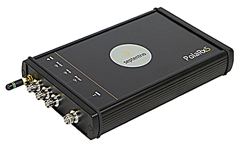
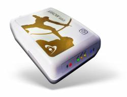
 Septentrio’s PolaRx5 GNSS receiver. Image source: Septentrio.
Septentrio has released its 5.1.0 firmware for the PolaRx5 product line of GNSS reference receivers. The PolaRx5 GNSS reference receivers include the PolaRx5 for Continuously Operating Reference Station (CORS) and network operations, time and frequency transfer, and space weather applications.
The 5.1.0 firmware includes new features for file management, usability, security, and seismic monitoring, the company said.
"The new features of the 5.1.0 firmware complement existing standard features of the PolaRx5 GNSS receivers such as advanced interference mitigation technology and the web [user interface] offering full user control and status," said Francesca Clemente, Septentrio PolaRx product manager.
Septentrio said that improvements in Precise Point Positioning (PPP) increased opportunities for seismic monitoring using GNSS technology. This includes allowing precise measurement of long-term slow surface displacement, the company said.
PolaRx5 allows real-time recording of high-frequency vibrations typically accompanying earthquakes, the company said. Firmware 5.1.0 also features support for on-board PPP and dynamic response for seismic applications.
The 5.1.0 firmware, available on Septentrio’s website, brings logging efficiency to PolaRx5 users, the company said.
Because transmitting data can be expensive, especially when using Iridium telemetry, Septentrio said it has developed a storage integrity feature to retransmit only the data which has been lost in the initial transmission. This avoids the common and unnecessary overhead of retransmitting complete files, the company said.
Some agencies using the PolaRx5 include the Oregon Department of Transportation (ODOT), UNAVCO, the Jet Propulsion Laboratory (JPL) and the Satellite Positioning Service of the German National Survey (SAPOS) CORS network in Germany.
The PolaRx5 works with GPS, GLONASS, Galileo and BeiDou, as well as regional satellite systems including Quasi-Zenith Satellite System (QZSS) and the Indian Regional Navigation Satellite System (IRNSS).


