Positioning, navigation and timing (PNT) technologies have become indispensable in an ever-widening range of industrial sectors. That trend promises to continue, with major players in the PNT industry making moves to expand their markets, lowering barriers and offering new means of entry, trimming price points and making integration easier.
Such moves were clearly on display at InterGeo.
New developments were in evidence at this year’s InterGEO, ostensibly the world’s largest trade fair for geodesy, geospatial data and land management.Boiled down, InterGEO is about surveying, but, like so many areas in this day and age—agriculture, transportation, defense and others—surveying would be nowhere without the firm foundation that is modern PNT.
We start our review of this year’s InterGEO, held in Stuttgart, Germany, with a new GNSS-inertial system by Trimble, designed for continuous mobile positioning and direct georeferencing applications, offered under a new purchasing model that will enable more and different customers to come in and play.

Lower Price Points, New Buying Options
“This is the big announcement of the show,” said Steve Woolven, president of Applanix, a Trimble company. “The APX RTX is the fourth generation of our APX product line and is targeted primarily at the UAV [unmanned aerial vehicle] market. Onboard, it’s got the ability to act as both an APX-50 and an APX-20.”
Applanix APX-50-like performance means, among other things, efficient and low-cost centimeter-level mobile positioning accuracy. The company’s APX-20 brought similar performance in a design optimized for UAVs. Now, the new APX-RTX adds features in a more-competitive-than-ever package.
As Woolven explained, “So you get that performance, an external IMU, but there’s more to it than hardware. Aside from the physical piece, you get a subscription to RTX.” That’s Trimble’s advanced precise point positioning (PPP) technology, the global GNSS correction service that provides centimeter-level, post-processed accuracy without the need for local base stations. “Everything is included,” Woolven said, “the post processed version of RTX and POSPac [mobile mapping software] come in the one bundle. All you need is the sensor, which would be primarily LiDARs or cameras.”
Trimble has managed to bring down costs using micro-electromechanical systems (MEMS). “These are quite a bit cheaper than other types, and MEMS performance is now so impressive,” Woolven said. “But the major difference is the business model approach. We’re going to market with this as a subscription model.”
By offering the APX RTK plus corrections and post-processing software as a single product, Trimble can essentially lower the overall cost of owning and operating a UAV, in a UAV market that is known for its price sensitivity. “It allows the customers to pay for the time they need,” Woolven said. “They can pay for a subscription for a certain period of time, so if they only want to work in the summer, they can then basically turn it off and put it on the shelf for the rest of the year.”

Reducing the cost means reducing a major barrier to entry, allowing more customers to be part of the UAV movement. The timing of the APX RTK launch is interesting, given the prospect of a new U.S. Federal Aviation Administration (FAA) regulation early next year. The so-called Part 108 would include rules for flights beyond visual line of sight (BVLOS), providing a springboard for a massive expansion of UAV operations.
“The APX can be used in crewed applications, but we’re really going after the UAV and beyond visual line of sight,” Woolven said, “and we’re making it so easy. Literally, all you have to do is turn the bird on and launch it. All the data gets recorded on the bird, including all the RTX corrections, on the bird. You don’t need to connect a computer to the internet to download corrections or upload files.”
It’s a case of technical readiness intersecting with market maturity, a system now more affordable and easier to use, enabling greater dispersion in terms of user communities and types of customers.

Open Architecture—Letting the Tools Loose
“Think about a surveyor,” said Joe Blecha, Trimble director of product marketing. “Someone who really knows surveying, but doesn’t know camera calibrations and image orientations—and doesn’t want to know. We’re trying to present data delivery solutions in a way that surveyors can understand, keeping the workflow easy, step-by-step, linear.”
Modern LiDAR scanners and digital cameras can deliver superb point clouds and orthographs, “But those are really interim deliverables,” Blecha said. “Nobody needs the point cloud. They need the information from the point cloud, and what we’ve been doing at Trimble for the last few years is creating better tools for turning the interim deliverable into actionable information.”
The goal is integration and distribution of data sets, including PNT data, to the people who need them, without killing them with the math behind it. It means enabling new user communities to come in and engage, finding new insights. All that’s left is to stand back and be surprised.
“We want to meet people where they’re at,” Blecha said. “We can’t respond to everybody’s needs ourselves because there’s so many different things you can do with this data, and that’s the point with open architecture. If we can provide a platform for creating new tools, a foundation that our customers can extend and adapt to serve their own needs, who knows what some of these smart engineering firms may do.”
Open architecture is kind of a new idea for Trimble, and it’s a trend being mirrored by other providers of proprietary data systems. The evolution toward more openness is logical. Consider a modern construction site, the number of operations going on, the subcontractors coming and going, the different data collection capabilities, all acquiring thick data sets that need to be integrated for broadest utility.
“Seamlessness and efficiency is not a Trimble thing, it’s an industry thing,” Blecha said. “Of course, we’d love to see nothing but those nice Trimble-stamped boxes and logos everywhere, but that’s not a reality or a requirement. We’re trying to be more open, and we’re bringing the capital costs down, with subscription models, where you can disperse the costs of a piece of technology over time. We’re not selling hardware. We’re selling capabilities and workflows.”

Hexagon Heights
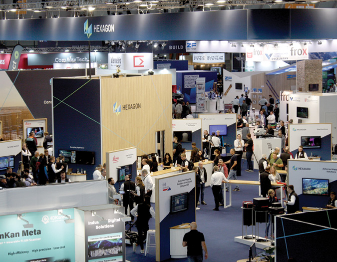
To understand just how firmly PNT underpins today’s surveying sector, one need only stroll through the InterGEO exhibition space and to note the dominant displays of PNT heavy hitters such as Trimble, Hexagon and Topcon, not to mention the plethora of smaller but highly innovative and up-and-coming PNT concerns.
Countless PNT-powered technologies were on show at Hexagon’s extremely popular stand, though the word “stand” seems wholly inadequate to describe the commotion that was, well, the Hexagon stand.
Among the items under examination was Hexagon Digital Reality (HxDR), described as a cloud-native platform for geospatial data at any scale, powering Hexagon’s digital reality applications with storage, visualization, collaboration tools and automated microservices for data processing.
Hexagon company Leica Geosystems announced a new, high-performance, single photon LiDAR (SPL) technology that can be integrated into hybrid sensors. In a communication, Werner Kirchhofer, VP of product development airborne solutions at Hexagon’s Geosystems division, described the new system as improving the efficiency of data collection over large areas, with its expanded 60-degree field of view and more than 500 measurement channels.
Also on hand was a returning PNT favorite, the venerable OEM7720, one in a line of multi-frequency GNSS receivers by Hexagon company NovAtel. The well-established, dual antenna-compatible unit continues to deliver precise positioning and advanced interference mitigation for space constrained applications and challenging environments, tracking current and planned GNSS constellations GPS, GLONASS, Galileo, BeiDou, QZSS and IRNSS. Firmware options include TerraStar corrections with RTK, ALIGN for precise heading and relative positioning, GLIDE for decimeter-level, pass-to-pass accuracy, and SPAN for continuous 3D position, velocity and attitude, none of which require any further ado from our side. No PNT, no party. Hexagon proved it.
Remapping the World
It now seems farther from outlandish than one would have thought to forecast the establishment in the not-too-distant future of a high-resolution digital twin of the Earth, one that will not only be complete but also constantly updated. Who will enjoy access to this resource and by what means are questions for another future. What we know now is the digital remapping of the world will rely heavily upon PNT-based technologies and will likely be realized, at least in part, through cooperative action, bringing together data from many sources and involving many, many contributors. Certainly, the more individuals and organizations there are with the tools and wherewithal to make meaningful contributions, the faster the remapping will be achieved.
LiDAR scanning will play a key part in the endeavor; the technology has certainly become a tool of predilection for the geospatial community. The Austria-based RIEGL, known as setting the gold standard when it comes to UAV-based LiDAR systems, and, by the way, a long-time user of Applanix navigation and positioning systems, drew attention at InterGEO with its recently launched VUX-100 LiDAR scanner. The unit is optimized for small UAV operations, delivering a level of data density sufficient for many tasks, but at an easier-to-swallow price point than the company’s top-of-the-line scanners.
My-Linh Truong, RIEGL division manager unmanned laser scanning, said RIEGL is targeting new clients who may have been interested in the company but who, because of financial constraints, have not been able to make the move. With the VUX-100 and other systems, Riegl is now prepared to bring more data collection solutions to a more diverse customer base. If the VUX-100 performs as expected, sales-wise, a more numerous and more varied user community will be gathering LiDAR data, and RIEGL will have brought us a step closer to the remapping of the world.
Easier To Integrate, Easier To Use
X20 is u-blox’s newly launched GNSS module, supporting all available GNSS satellite signal bands and providing centimeter-level accuracy globally. The module boasts end-to-end security functions, advanced jamming and spoofing detection, and software features that make it useful in industrial automation, automotive, UAV, ground robotics and other safety-critical applications.
“X stands for all-band,” said Marten Ström, u-blox senior principal product manager, positioning. “That’s L1, L2, L5 and L6, and that’s a big deal. With all-band, you get cross-checking possibilities against jamming and spoofing. Security is a serious concern right now, especially if you look at marine and automotive applications.
“Of course, Galileo HAS [High Accuracy Service] is on L6, this new kind of PPP.” HAS will provide high-accuracy corrections, free of charge, in the Galileo E6-B data component as well as by terrestrial means. “It’s in the chip,” Ström said, “and our customers will want to try it and decide for themselves. The X20 platform has the smallest power consumption we see in the market, but it’s the accessibility to all bands that makes it so special. We are the first European and the first Western company to offer L6 band on this kind of module. We are opening up the doors for creative and smart system integrators to make use of it. We think more bands will become more common, and we are not talking about the highest end. We’re talking mid-range type receivers.
“There are so many emerging user communities and industrial applications. We put this in their hands and welcome them to embrace the technology. Let them figure it out, and we’ll see what they can do with it.”
The X20 is also enabled for Galileo open service navigation message authentication (OSNMA). “This is a very powerful solution,” Ström said. “It’s one of the gems of Galileo. There are also new antenna options. We want our customers to look closely at all of this and digest the possibilities.”
Ström called the new X20 the biggest launch of the year, and maybe next year. “It’s about high accuracy,” he said, “but even more, once you’ve achieved one-centimeter, two-centimeter accuracy, what our customers really want is availability and robustness, and this is how they get it.”
More Means Merrier
Not to be topped, Topcon had its own big announcement at InterGEO, concerning a new partnership with the aforementioned u-blox. The agreement sees two best-in-class elements coming together.
“This is not another wishy-washy partnership. This is real,” said Ian Stilgoe, vice president, Global Emerging Business, Topcon Positioning Systems. “We’re combining the high-volume, mass-market application products and knowledge of u-blox with the high-level precision GNSS services and expertise of Topcon. This is not only expanding our global footprint, but also offering scalable services that cater to a wider range of precision GNSS needs.”
Ari Kuukka, u-blox principal product owner, said, “We see a lot of new things coming due to this cooperation, especially talking about the correction services, segments where Topcon has been focusing traditionally. We are kind of a new entrant on that market, where our strategy has really been to focus on robotics and emerging use cases, where the customer might have thousands, tens of thousands, even hundreds of thousands of devices, but without requiring high-end, one-centimeter accuracy.”
“We live in different worlds,” Stilgoe said, “with different focuses and expertise. There’s surprisingly little overlap.”
Historically, u-blox customers have had to go somewhere else to get high-accuracy corrections. “At u-blox, we provide modules to OEMs who create user products,” Kuukka said. “In the past, those OEMs would sell their equipment and their customers would pick an RTK service if they needed it. But more and more, OEMs want to embed the correction service in the product to offer their customers the full solution.”
“The one-stop-shop mentality is becoming more important,” Stilgoe said, “as is supply chain traceability. This deal makes sense all around.”
On the infrastructure side, Topcon and u-blox each have their own networks of base stations for correction services. “If we put them together,” Stilgoe said, “our customers suddenly have thousands more base stations at their disposal. This is filling gaps in our coverage, and we’ll save money on new infrastructure as we move into new areas. It should be a big deal for the market, especially for OEMs, and not just in the survey industry. Not all of them know about coordinates, inertial integrations, geometry and such. They just want it to work. There are customers out there who may not even know about RTK. If they have access to this, they suddenly realize what’s possible.”
As we saw with Trimble, Topcon and u-blox now consider open architecture as a forward-looking, democratizing force. “We have to make it easier for customers and OEMs to implement high accuracy,” Kuukka said. “We can create new opportunities and new benefits, very short-term, with a cooperative approach.”
“We’re bringing it all together so that you have a single sign-on,” Stilgoe said. “People who still maintain closed architectures have got to realize, you can’t do that in the modern world.”
Apps and Users
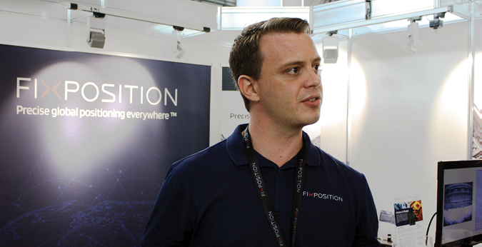
Lest we imagine the PNT representation at InterGEO was all about bigger, larger and huger, we find the smaller Fixposition, the Swiss concern, making a big pitch with its Vision-RTK2. This solution combines GNSS technology with advanced computer vision and machine learning to deliver centimeter-level positioning accuracy under all conditions. When GNSS signals are disrupted, Fixposition vision fusion takes over to maintain positioning accuracy. The company’s mantra is “precise global position, everywhere.”
“Our customers are makers of tractors and big lawnmowers,” Fixposition Co-Founder and CTO Lukas Meier said. “Orchard operations are another big topic right now, but you’ve also got container parks, where there’s real money to be made.”
Fixposition has an important customer in the Netherlands, integrating the company’s modules into autonomous container transport vehicles. Seaports, which face challenges with multipath and jamming, have been designated by the U.S. Department of Transport as critical infrastructure, which translates indeed into money to be made.
“We do software, we do the module, we have the sensors, and we also do post-processing,” Meier said. “What we need is integrators.” One of Fixposition’s clients is Greenzie, a leading software company out of Atlanta, developing fully autonomous commercial lawnmowers and industrial equipment. “In the U.S., lawn mowing is a big market,” Meier said. “We like Greenzie because they’re integrators. If we have to do the integration, we can do it one by one, but they do 10 at a time. What we would like to see is a scaling autonomous vehicle, a lawn mower which is sold 50,000 times, and there are some coming up. Lots of them are Asian. We would like to see more from Europe or the United States.”
In 2023, Fixposition teamed up with Topcon and Topnet Live, using precise and reliable GNSS positioning to bring autonomous systems to more applications and more users. “For us, InterGEO is like the family reunion,” Meier said. “We meet the Topcons, we meet the RIEGLs, the Hexagons and the Trimbles. They’re all here.” He says it with a smile.
And more and more, it seems, they’re on the same page, opening new markets to new entrants, sometimes lowering price points, sometimes making integration easier, always making things easier for the user. Again, the timing is propitious, with enabling regulatory frameworks taking form in the U.S. and Europe. Costs are coming down, and the prospects of new uptake are appealing.


