New Board Designation Expected This Fall
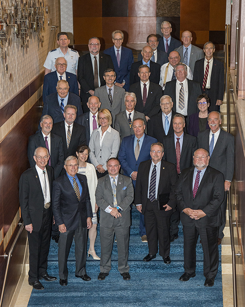
The leading U.S. panel of satellite navigation experts, the National Space-Based Positioning, Navigation, and Timing Advisory Board (“PNT Advisory Board”) opened its June meeting with a renewed charter, a new chairman and seven new members.
Established in 2004 the board provides “independent advice to the U.S. government on GPS-related policy, planning, program management, and funding profiles in relation to the current state of national and international satellite navigation services.” It undertakes research and submits recommendations and reports to the National Executive Committee for Space-Based PNT (ExCom)—a joint civil/military policy body comprising eight federal agencies and the Joint Chiefs of Staff. The board tackles tasks at the request of the ExCom and addresses issues it identifies itself as needing attention.
The board has a new charter that was just signed in May. That charter only extends to September, however, because the board is expected to be chartered again with a designation as one of the President Donald Trump’s key advisory groups. Special designation within the executive branch gets the board additional attention and focus, explained a source familiar with the process.
“I guess that means we get a promotion,” quipped Admiral (Ret.) Thad W. Allen, the board’s new chairman.
Allen served as commandant of the U.S. Coast Guard from 2006-2010 leading the service through a major modernization program and an effort to explore the changing Arctic as well as a number of significant national and international incidents, including hurricanes, floods, search-and-rescue cases, oil spills and other environmental incidents. He is now an executive vice president of Booz Allen Hamilton.
The immediate past board chairman John Stenbit, who previously served as assistant secretary of defense, will stay on the board as deputy chairman.
The new members bring the board up to its full compliment of 25. Allen noted that this might be the largest contingent of new members the board has ever had. The new members are:
Patrick Diamond, Diamond Consulting
The principal of Diamond Consulting, Patrick Diamond has been at the forefront of the development of timing and synchronization technologies for more than 20 years. He led the development of the first monolithic silicon device for synchronization in SONET/SDH networks. Diamond was the original evangelist for creating a version of IEEE 1588 for use in packet wide area networks and led development of the only fully integrated 1588v2 system on a chip currently deployed in over 2 million base stations. He has worked at NASA, McDonnell Douglas, Data General and Semtech in senior and executive engineering and business development roles.
Frank van Diggelen, Google
Frank van Diggelen is a principal engineer at Google, where he leads the Android Core-Location Team. He is a pioneer in Assisted GNSS, the technique that allows GPS to work in cell phones. He is the inventor of coarse-time GNSS navigation, co-inventor of Long Term Orbits for A-GNSS, and holds more than 90 issued U.S. patents on A-GNSS. He also teaches at Stanford University, where he created an on-line GPS course, offered free through Stanford University and Coursera. In its first release this course attracted over 30,000 registrants from 192 countries. He previously served as a navigation officer in the South African Navy.
Dorota Grejner-Brzezinska, Ohio State University
Dorota Grejner-Brzezinska is a professor in the Department of Civil, Environmental and Geodetic Engineering and serves as the associate dean for research in the College of Engineering at Ohio State University (OSU). She is also a director of the Satellite Positioning and Inertial Navigation (SPIN) Laboratory. Her research interests cover GPS/GNSS algorithms, GNSS/inertial and other sensor integration for navigation in GNSS-challenged environments, sensors and algorithms for indoor and personal navigation, image-based navigation using artificial intelligence (AI) methods, and mobile mapping.
Terry Moore, University of Nottingham (UK)
Terry Moore is director of the Nottingham Geospatial Institute at the University of Nottingham where he is the professor of satellite navigation. He has many years of research experience in surveying, positioning and navigation technologies and is a consultant and adviser to European and UK government organizations and industry.
Jeffrey Shane, International Air Transportation Association (IATA)
Jeff Shane is IATA’s general counsel where he is responsible for managing its Legal Services group, the delivery of legal support to IATA’s operational units around the world, and for working with IATA’s member airlines to address legal issues of importance to the industry at large. In addition to his 14 years in private law practice, he served as under secretary of transportation for policy between 2003 and 2008 and was deputy assistant secretary of state for transportation affairs for four years, serving as chief U.S. aviation negotiator. Shane was an early champion of the “NextGen” transformation of the U.S. air traffic control system, the acceleration of GPS modernization, and other technology initiatives to enhance the safety, security, and efficiency of aviation and other modes of transportation.
Gary Thompson, North Carolina Emergency Management/Geodetic Survey
Gary Thompson has worked since 1977 for the North Carolina Geodetic Survey (NCGS), which is responsible for developing and maintaining North Carolina’s official survey base. He put the agency’s modernized technologies, expertise, and quality control to the test while on the research team that conducted Light Detection and Ranging (LiDAR) aerial mapping research projects with NASA. He incorporated the results of those projects into practice while on the program management team that completed the engineering and surveying project that produced a statewide set of Digital Flood Insurance Rate Maps (DFIRMs). He also serves as the deputy risk management chief (NC Emergency Management). He is currently leading efforts to utilize Unmanned Aircraft Systems (UAS) for North Carolina Emergency Management.
Todd Walter, Stanford University
Todd Walter is a senior research engineer in the department of aeronautics and astronautics at Stanford University, where he has been a research staff member since 1993. His research focuses on implementing high-integrity air navigation systems. He is one of the principal architects of the Federal Aviation Administration’s (FAA) Wide Area Augmentation System (WAAS) safety processing algorithms, including development of the ionospheric estimation and confidence bounding algorithm, as well as the WAAS integrity monitors. He has performed a similar role on the equivalent systems deployed in Japan and India. He also advises the FAA on alternate means to exploit satellite navigation signals to provide safety-of-life services more efficiently.
The other board members are:
— Bradford Parkinson (1st Vice Chair), Stanford University
— James E. Geringer (2nd Vice Chair), Environmental Systems Research Institute (ESRI)
— Penina Axelrad, University of Colorado
— John Betz, MITRE
— Gerhard Beutler, International Association of Geodesy (Switzerland)
— Scott Burgett, Garmin International
— Joseph D. Burns, Airo Drone
— Sergio Camacho-Lara, United Nations Regional Education Center of Science and Space Technology – Latin America and Caribbean (Mexico)
— Ann Ciganer, GPS Innovation Alliance
— Dana Goward, Resilient Navigation and Timing Foundation
— Ronald R. Hatch, private consultant (retired John Deere)
— Matt Higgins, International GNSS Society (Australia)
— Larry James, Jet Propulsion Laboratory
— Timothy A. Murphy, The Boeing Company
— T. Russell Shields, Ygomi
— Refaat M. Rashad, Arab Institute of Navigation (Egypt)
There are a number of issues the board members are considering working on. The first is the concept of a PNT gold standard and what that means. Also on the table is an analysis of the space volume, that is the use of satellite navigation signals by satellites and other spacecraft, the ramifications of 5G telecommunications and the establishment of an integrated GNSS system that serves the entire globe. There is also a question about whether the older satellites in the current GPS constellation should be replaced sooner rather than later as a way to more quickly add new signals like L5 and improve overall capability.
“Part of it is the launch schedule and the fact that we rightfully take a lot of pride in 25-year-old satellites,” said the board’s Vice Chairman Brad Parkinson. “On the other hand those satellites are occupying a slot. They do not have L5. They do not have L1C. They do not have L2C and in general they’re aged satellites in terms of their capabilities. And the question is what is the right place in the tension between renewal and saving money.”


