The U.S. stance on satellite navigation has long supported international cooperation and a degree of interoperability. In 2010 the Obama administration even adopted a space policy that said foreign satnav services could be used “to augment and strengthen the resiliency of GPS.”
That was easier in the abstract, however, when the only fully functional GNSS was GPS. Now, with other GNSS services coming online, American officials want to think things through again.
In fairness, U.S. satellite navigation policy has been complicated by more than the advent of other constellations. The White House adopted its space policy at the same time as its freshly minted broadband plan, and it seems unlikely anyone anticipated the bare-knuckle spectrum fight that would ensue.
Some 75 percent of Americans still had a landline telephone in 2010, Russia’s GLONASS program was having launch problems, Crimea was still part of Ukraine, and few in the GPS community knew that other countries would be required by law to have their satellite navigation signals authorized for use in the United States — something no other country demands.
That requirement is now at the center of a multi-agency debate that has been going on for months. Inside GNSS has learned that the Europeans have asked for authorization of Galileo signals in a letter submitted as early as last November. Since then, a string of interagency meetings having taken place about the authorization issue, some at very high levels.
A factor in the discussions is a report and order adopted by the Federal Communications Commission (FCC) on January 29 setting new location standards for Enhanced 911 (E911). The move is necessitated by a broad shift from landlines, whose locations are known, to cells phones where the location often cannot be determined accurately. Some 40 percent of telephone owners now have only mobile devices, and the majority of mobile calls are made from indoors where GPS signals are less likely to penetrate. The majority of emergency calls now come from cell phones, the FCC said in its decision.
The “Roadmap for Improving E911 Location Accuracy,” an approach proposed by the four major wireless carriers and two emergency communication associations, had suggested tapping GLONASS signals to improve the location accuracy, especially horizontal accuracy, for emergency calls. The FCC took a technology-neutral approach but made it clear that signals from non-U.S. GNSS systems had to be authorized before they could be used to help find cell phone users dialing 911 in an emergency.
Surprise
The FCC requirement for such formal approval of non-GPS satellite navigation systems had only come fully to light a month earlier at the December meeting of National Space-Based Positioning, Navigation, and Timing (PNT) Advisory Board, the country’s leading satellite navigation experts.
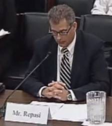
“Section 301 (of the Communications Act of 1984) basically says you need a license from the FCC if you are going to transmit any energy intentionally from some radio transmitter in radio frequency spectrum,” said Ron Repasi, deputy chief at the Federal Communications Commission (FCC) during a presentation at the meeting.
The licensing process, which is implemented and enforced by the FCC, has its roots in the World Trade Organization (WTO) Telecom Agreement of the late 1990s, he said. The agreement was intend-ed to ensure that American companies received fair access to markets in countries granted access to U.S. customers.
The requirement for authorization, however, could create significant challenges for the GPS program and for those who operate in the GNSS receiver markets.
Of course, if authorization were easy to obtain, it might help.
Authorization How-To
Several avenues are available for getting authorized, and either the countries operating the constellations or the receiver manufacturers/marketers — sometimes both — need to seek approval.
“The rules that are in place for requiring authorization of nonfederal receivers of foreign systems have been in place for quite a while, and there are many ways to deal with that requirement,” Repasi told Inside GNSS. Countries could seek a waiver for a type of application such as navigation satellites, he explained, or ask to have a constellation added to the Permitted Space Station List. Although the process requires a thorough review, once a GNSS is added to the list, receivers can use its signals without having to file any paperwork.
At the international level the process would most likely start with the State Department. State would pass on a nation’s request to the National Telecommunications and Information Administration (NTIA), the organization that is the focal point for spectrum decisions within the executive branch. NTIA would then work with other federal agencies to decide how to proceed and eventually, if appropriate, submit the request to the FCC.
NTIA said in a 2011 letter that it intended “to recommend, on a case-by-case basis” that the FCC grants waivers for radionavigation satellite services (RNSS). Before deciding each case it would weigh whether 1) the waiver was in the public interest, 2) whether the system complied with the United Nations space debris mitigation guidelines, 3) whether a waiver was consistent with U.S. international trade and other treaty obligations, 4) whether the waiver request was actually limited to receive only RNSS, and standard time and frequency satellite services and finally 5) whether the operation of the signals in question was compatible with U.S. government systems.
At least one aspect of the process is simple. The NTIA has the ability to grant waivers or authorization for federal users; so, NASA or other agencies with programs that might benefit from multi-GNSS receivers will not be hampered.
Receivers, Too
Once the FCC receives a request from NTIA, it looks at whether the proposed transmissions could interfere with non-federal U.S. operators either using the requested frequencies or operating in nearby bands.
To do this the agency relies not on testing but on a comment process where those who might be affected are given an opportunity to file their concerns. Those providing the signal get a chance to respond and present their perspectives as well. The FCC can then decide to grant or not grant authorization, provide a waiver, or put the constellation on the Permitted List.
Receivers using only signals from GPS and systems that obtained waivers or are on the Permitted List don’t need to submit any further paperwork. In all other cases, receivers need to be licensed or registered. The makers or perhaps marketers would file Form 312, plus supporting documentation, with the FCC.
The rules regarding the receivers (called earth stations by the FCC) and system providers are found in title 47 of the Code of Federal Regulations (CFR). The Google-able citations are 47 CFR § 25.131(j)(1) for receivers and 47 CFR § 25.137 for the space segment.
As with system applications, receiver applications are published for comment. If there is no comment within 30 days, the license is granted automatically.
It is unlikely, however that the 30 days will pass unmarked for GNSS.
Leverage
One very interested party all but certain to comment on any GNSS receiver application is LightSquared. The company wants to launch a nationwide wireless broadband system using frequencies near those used by GPS and the other GNSS services, effectively rezoning those frequencies to support a high-powered terrestrial service.
Tests in 2011 showed, however, that the network’s powerful signals would overload the vast majority of the country’s GPS receivers. The FCC put the plan on hold, and the firm eventually filed under Chapter 11 of the bankruptcy law.
The company is now emerging from bankruptcy and pushing hard for consideration of a new, more measured plan that would forgo the use of the most controversial frequencies — at least for a while. Even with that concession, the company is still contending with the GNSS community and its installed base of, and market for, devices that receive signals outside of the GPS band so as to provide highly accurate results. The company has been trying to bring three key firms — Trimble, Garmin and John Deere — to the table to work out a compromise. After the collapse of court-ordered negotiations, it even appealed to the FCC to help kick off the talks.
On July 2 LightSquared asserted in an FCC filing that firms seeking to license their receivers should have agreed to accommodate their neighbors.
“We are not aware of any Form 312 request for GLONASS pursuant to subsection (j)(1), and GLONASS is not on the Permitted Space Station List,” LightSquared wrote. “As such, it is contrary to the Commission rule for a person to provide location services today in the United States based on a foreign satellite signal such as GLONASS without obtaining a license. If a member company in the [GPS Innovation] Alliance or some other entity were to seek such a license, it should have to agree at least to follow an industry established protocol for receivers that secured the public policy goal of maximizing the economic value of all the L-band spectrum, which means accommodating both satellite and terrestrial signals.”
While this could be interpreted as wishful bluster, the FCC’s position over the last four years suggests it will be far more sympathetic to LightSquared’s position than that of the GPS community. The agency was widely seen in 2011 as supportive of LightSquared’s original proposal and lacking an understanding of the differences between satellite navigation and telecommunications signals and applications that make the sort of accommodations typical between telecom firms difficult if not impossible for GNSS-related companies.
Moreover, the FCC has been charged by the White House with finding some 500 megahertz of additional RF spectrum for broadband by 2020. Should the FCC authorize foreign GNSS signals in the United States, it will be obligated to protect those signals from interference — limiting its maneuvering room in the very desirable L-band.
The December discussion before the PNT Advisory Board hinted at this issue. Repasi commented more than once on the seemingly unrelated Adjacent-Band Compatibility Assessment, which is being conducted by the Department of Transportation. The study aims to determine what power levels can be used safely in spectrum bands adjacent to those frequencies used by satellite navigation without interfering with the GPS signal and other GNSS services both now and in the future. The assessment could effectively cap what is possible in adjacent bands.
LightSquared has taken a number of shots at the ABC Assessment, suggesting that it is overly cautious. It has gone as far as commissioning its own tests of GNSS receivers and filing a minority report objecting to the consensus reached on ABC Assessment–related technical questions by an RTCA aviation standards-setting body.
High Stakes
One of the most confusing and potentially problematic aspects of this debate is that it is about authorizing signals that are already available and in use. iPhones have a dual GPS/GLONASS chip. Five Galileo satellites are now in operation and their signals reach the United States. (In fact, the Galileo signals stretch all the way to the poles — a big plus as the Arctic and Antarctic ice recedes and the United States moves to protect its security and economic interest there.) The vast majority of receivers made today are multi-GNSS.
“Right now there are literally hundreds of thousands of GPS-GLONASS nonfederal receivers using GLONASS for very useful purposes, to navigate tractors and all kinds of stuff, and iPhones probably,” said Brad Parkinson, the acting chair of the PNT Advisory Board during the meeting. “The horse has sort of left the barn.”
While it is not illegal to have a multi-GNSS receiver, until the signals and receivers are authorized/licensed, nonfederal organizations engaged in regulated activities such as E911 services in the United States will not be allowed to use equipment that incorporate non-U.S. GNSS signals.
“The capability to operate with foreign satellite signals presents regulatory concerns of unauthorized use if that capability can be activated either intentionally or unintentionally by end users prior to FCC authorization,” the FCC wrote in its E911 decision. “We encourage CMRS [Commercial Mobile Radio Service] providers or cell phone providers seeking to employ foreign satellite navigation systems to begin the approval process as soon as possible.”
Some 68 nations were set to sign that first WTO Telecom agreement when it was finally approved. New deals have been hammered out since, and a dozen or more additional nations have signed on, according to a WTO matrix. No other nation, however, has insisted on authorizing GPS signals — at least not so far, experts have told Inside GNSS. U.S. representatives are worried that might change if a resolution of the matter is not found promptly.
Manufacturers of multi-GNSS equipment could find their business affected if transmissions from the Galileo, GLONASS and eventually BeiDou constellations are not protected.
“If we don’t authorize their signals,” Parkinson said, “there is a danger that they are going to turn around and say: ‘We’re not going to use your signals.’”
No Rush, But Russia
The NTIA has yet to approve the release of the European letter by the FCC. Given what is at stake, it is perhaps understandable. Once the FCC publishes the requests — and it is obligated to put authorization requests out for public comment — the cat will be fully out of the bag.
Another far less clear consideration may also be at play in the delay.
Inside GNSS has learned that national security concerns are a factor in some of the ongoing interagency meetings. Exactly what those concerns are, however, is unclear.
During the heated rhetoric surrounding the E911 debate those opposing using GLONASS suggested the Russian signal could be spoofed, slowed, or otherwise degraded.
“In view of the threat posed to the world by Russia’s Vladimir Putin, it cannot be seriously considered that the U.S. would rely on a system in that dictator’s control for its wireless 911 location capability,” Rep. Mike Rogers, R-Alabama, and chairman of the Armed Services subcommittee on strategic forces, wrote in a letter to the secretary of defense and director of national intelligence.
Although concerns have arisen in the past about the transparency of the GLONASS system and operational difficulties, criticisms of GLONASS and others that have been aired in public have been dismissed as, at best, misinformed by experts in signal interference, constellation structure, and spoofing.
So what is the security concern? History suggests something more global and diffuse.
Relations between the United States and Russia, especially after the annexation of Crimea, are described by experts as being at their lowest point since the Cold War, a period during which the United States and the Soviet Union competed for influence in a variety of ways, including by demonstrating their technological prowess.
News reports, primarily from Russian government-controlled media, describe a wide-ranging push to promote the GLONASS system over the last year. The Moscow Times reported in May 2014 that the Russia’s Economic Development Ministry had signed on to an agreement with GLONASS to increase the firm’s global market share.
Russia, which is also pushing for monitoring stations in some 36 countries to help improve its signal accuracy and integrity, wants to see its Customs Union trading partners adopt GLONASS along with Brazil, India, Indonesia, South Africa and nations in Latin America, Southeast Asia, the Middle East, and Africa. In another article about trade negotiations in which Putin played a personal role, Russia Today reported in November that Russia was considering “joint use” of GLONASS with Peru and assistance with other “state-of-the-art technologies.”
The United States has a clear policy goal of maintaining its leadership in GNSS service, provision, and use. If GNSS-related jostling is taking place between it and Russia, but the United States authorizes GLONASS, even integrates it into its E911 systems, would it be helping Russia achieve its aims through a tacit endorsement? Would it suggest to observers not familiar with the general strengths and weaknesses of satellite navigation signals that GNSS receivers are somehow less rather than more useful and reliable if GLONASS is added?
At this point no one has suggested that Russia has applied for authorization for GLONASS, which would be necessary to incorporate the signals into E911. The only application so far is from the Europe, confirmed sources, who all spoke on condition of anonymity because of the sensitivity of the subject.
Galileo, however, is not ready yet to support E911. But that’s not the point, one insider explained. If you approve one application, you set a precedent for all that follow. “That’s the way it is with spectrum.”
Whatever the international concerns, the decisions affecting nonfederal users appear to be squarely in the hands of the FCC — and the frustration with that organization in Washington is thicker than the humid summer air.
Those who spoke to Inside GNSS about the authorization law were vexed at the latest development and the prospect of yet another spectrum fight. Some questioned whether the FCC could use a decades-old law meant for telecommunications services to gain leverage over GNSS. The uncertainty surrounding the issue may be at the root of why NTIA is still holding on to the first request, keeping it from going forward.
“We don’t know what the FCC is going to do,” said one exasperated expert.


