Researchers at the Technical University of Denmark (DTU) have developed a method to monitor daily ice loss in Greenland using data from 61 GPS stations installed on the bedrock around the island. This approach allows for precise tracking of ice melt, providing day-by-day data that enhances understanding of sudden changes in ice mass, especially during the summer.
Innovative Monitoring Method
When Greenland’s ice sheet melts, the underlying bedrock rises due to reduced pressure. This elevation change, detectable by GPS, translates into precise measurements of ice loss. Valentina Barletta, a senior researcher at DTU Space, explained the significance: “This is the first time we can measure the entire mass loss of the ice sheet day by day.”
The new method, detailed in Geophysical Research Letters, allows for daily monitoring, a significant improvement over previous methods that provided monthly or annual estimates. Greenland loses about 5 cubic kilometers of ice per week, equivalent to draining Denmark’s largest lake, Arresø, 40 times weekly.
Practical Applications and Benefits
The new GPS-based method not only advances climate research but also offers practical benefits, such as flood warnings for Greenland residents. By monitoring daily changes in ice mass, local populations can be warned of potential flooding due to sudden meltwater release, as experienced in Kangerlussuaq in 2012.
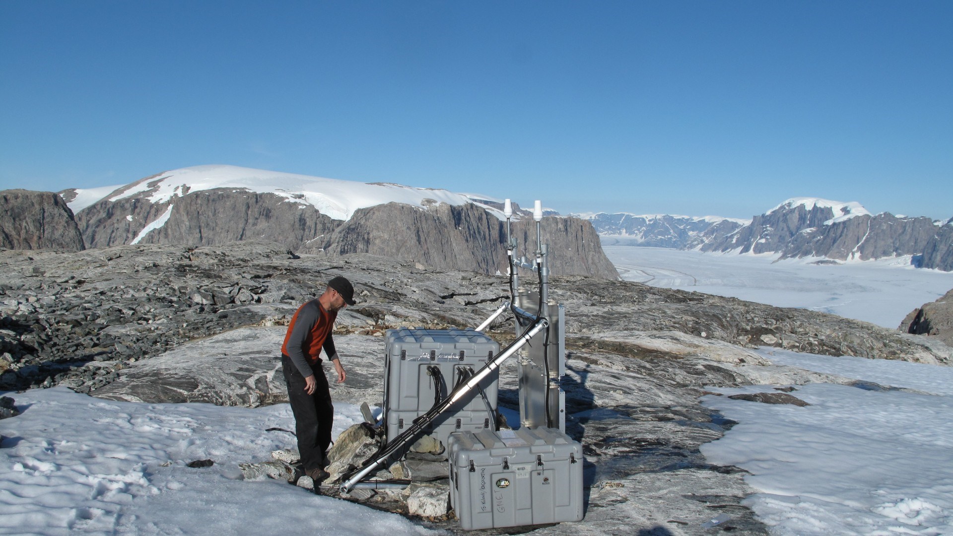
The system uses data from the Danish state’s GNET, operated by the Danish Geodata Agency in collaboration with DTU. The GNSS technology, which includes GPS and Galileo, detects sub-millimeter changes in bedrock movement.
Malte Nordmann Winther-Dahl, project manager for GNET, emphasized the importance of maintaining these measurement stations: “We are pleased that data from the GNET stations is so widely used and gives us new opportunities to accurately monitor climate change in Greenland.”
Implications for Climate Science
This method complements existing techniques such as NASA’s GRACE satellites, altimetry satellites, and ice movement measurements, providing a more comprehensive understanding of ice mass loss. The study and the new method were developed in collaboration with DTU Space and DTU Compute, leveraging their expertise and computational power.
The enhanced monitoring capability will aid the UN Intergovernmental Panel on Climate Change (IPCC) in making better estimates for future ice sheet melting and its contribution to global sea level rise, thereby improving climate change predictions and response strategies.
Read more about the research via DTU.


