space Archives - Page 2 of 4 - Inside GNSS - Global Navigation Satellite Systems Engineering, Policy, and Design

April 1, 2020

Small Packages, Big Missions. Simulation Testing of CubeSats Before Launch is Critical

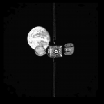
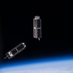
Hundreds, thousands of tiny satellites no bigger than a breadbox orbit the Earth, gathering a staggering amount of data and relaying petabytes of communication. These nanosatellites, commonly called cubesats, serve a variety of research and, increasingly, commercial roles. They work for science, exploration, technology development, education, telecommunications and other operations.

They are built to a standard dimension of 10 cm x 10 cm x 10 cm, or small multiples thereof. Typical weight is less than 1.33 kg (3 lbs) per U, or Unit, which equals on 10 cm cube.

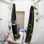
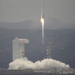
Among other launch opportunities, the National Aeronautics and Space Administration’s (NASA’s) CubeSat Launch initiative (CSLI) can give a ride up to small satellites as auxiliary payloads on planned rocket missions.

To meet performance requirements, commercial cubesats must often report from a precisely known location. Faulty positioning can produce inaccurate data that will adversely affect commercial operations on Earth. Cubesats typically carry a commercial GPS L1 receiver to determine their orbit, as altitude and orbit determination and control form key parameters.

Cubesats often fly in formation and wil then use a GPS/GNSS receiver to co-ordinate and synchronize among themselves. Finally, they use GNSS for onboard synchronization of operations and for precise timestamping of Earth observation data

Though small is size, cubesats can carry a large price tag, up to hundreds of thousands of dollars per project. Pre-launch testing for quality assurance is critical, particular of the satellites’ PNT capabilities. Earth-bound testing cannot replicate the conditions of low-Earth orbit, where the satellites will be moving at several kilometers per second, and need to maintain awareness of the also moving GNSS satellites above them in mid-Earth orbit. Thus the key role of GNSS simulation in this burgeoning industry.

The content of this article is largely drawn from a blog post by Talini Pinto Jayawardena, a space science technologist with Spirent Communications, and also a research manager at the University of Bath. To read her full blog, which contains a detailed description of key performance criteria to test with a simulator, visit here.

Extensive discussion of Doppler shift handling, precise orbit determination, antenna performance, time synchronization, special events, onboard interference handling, and the impact of environmental test (vibration and thermal vacuum) is presented.


By Inside GNSS
March 6, 2020

Rescue Satellite Makes Space Navigation History

In late February, Northrop Grumman’s Mission Extension Vehicle MEV-1 autonomously docked with another satellite in geostationary orbit in space, making navigation history.  It simultaneously took the next step in satellite operation by extending Intelsat 901’s lifetime beyond its original plan. The so-called “rescue satellite,” built by Northrop Grumman subsidiary Space Logistics, used a combination of traditional ranging, optical orbit determination from ground, and on-board sensors (visible, infrared, and LiDAR)  for relative navigation in space to make its ultra-precise rendezvous 35,786 km above Earth.

The successful operation means a potential sea change in satellite operation: their lifetimes can be extended, and defunct satellites can be moved to safer orbit even after their fuel supplies are exhausted.

The complex series of maneuvers to bring the two satellites together began with an October 2019 launch of the MEV-1. Northrop Grumman controllers undertook a series of engine burns to raise MEV-1’s orbit from its highly elliptical geostationary transfer orbit up to a circular orbit 300 km above the geosynchronous belt. Shortly thereafter, Intelsat decommissioned its satellite 901, and it used the last of its propellant to move into the GEO graveyard orbit.

MEV-1 approached.

For 19 days, MEV-1 advanced upon and withdrew from Intelsat 901, calibrating its navigation sensors: optical cameras, infrared cameras and side-scanning LiDAR to orient and position itself relative to Intelsat 901.

5
Images courtesy Northrop Grumman.

For the final delicate and very precise maneuver, on February 25 MEV-1 autonomously flew to 20-meter distance, pausing before resuming travel to the critical 1-meter docking position. It autonomously extended a docking probe, engaging an engine nozzle aboard Intelsat 901. A nozzle, by the way, that was never designed for docking purposes.

MEV-1 then extended a group of internal grippers to anchor the two satellites together.

The satellite duo are now jointly performing stack on-orbit checkouts. Later this month, MEV-1 will relocating the two of them to a GEO spot over the central Atlantic, where Intelsat 901 will take over services for another Intelsat satellite, providing C-band service in the Americas, Europe, and Africa.

MEV-1 will then, like the Lone Ranger, bid farewell to Intelsat 901 and move on to a new mission.

By Inside GNSS
January 7, 2020

GPS Has Role in Probing Universe’s Mysteries

International astronomers linked observations from eight telescopes, including the the Canadian Hydrogen Intensity Mapping Experiment (CHIME), to pinpoint the location of a repeating fast radio burst (FRB), a little-understood and seldom-observed astronomical phenomenon that may hold keys to the origin of the universe. GPS played an important role in coordinating the telescopes and their milliseconds of data.

Read More >

By Inside GNSS
August 21, 2019

Second GPS III Space Vehicle ‘Magellan’ Launched Aug. 22

The second Lockheed Martin-built GPS III space vehicle (GPS III SV02)—also known as Magellan—was recently encapsulated within its protective fairings in preparation for Thursday’s scheduled launch. GPS III will launch tomorrow from Space Launch Complex-37 (SLC-37) at Cape Canaveral Air Force Station, Florida.

Read More >

By Stan Goff
May 30, 2019

Air Force Lab Plans R&D into Celestial-Aided Navigation Tech

The Air Force Research Laboratory (AFRL) is considering a contract for research and development of celestial-aided navigation technologies. The primary focus is to develop a Star Tracker that can reliably perform celestial sightings for sensor altitudes between 30,000 feet and 80,000 feet. The goal is to reduce the risks to guidance, navigation and control in GPS-denied environments, especially for operations over feature-poor terrain such as desert, water, snow and ice where existing terrain-aided methods may not be used for position, navigation, and timing (PNT) updates.

Read More >

By Inside GNSS
IGM_e-news_subscribe