GPS Archives - Page 21 of 28 - Inside GNSS - Global Navigation Satellite Systems Engineering, Policy, and Design

November 8, 2018

NavtechGPS Offering GNSS Operations for Engineers Course at ESA/ESTEC

NavtechGPS is offering a training seminar later month titled Course 336: GNSS Operations for Engineers at the European Space Agency (ESA/ESTEC) in Noordwijk, The Netherlands.

This 3-day course offers a comprehensive introduction to GPS/GNSS and DGPS technology, system concepts, design, operation, implementation and applications. Detailed information on the GPS signal, its processing by the receiver, and the techniques by which GPS obtains position, velocity and time will be covered, together with a full day on differential GPS.

Read More >

By Inside GNSS
November 6, 2018

GPS Innovation Alliance Celebrates NASA’s 60th Anniversary

WASHINGTON – The GPS Innovation Alliance (GPSIA), an organization dedicated to furthering GPS innovation, creativity and entrepreneurship, commends NASA on its momentous 60th anniversary. GPSIA celebrates the occasion by recognizing the vital role NASA has played in furthering and facilitating the growth of GPS around the world.

Read More >

By Inside GNSS
November 1, 2018

Harris Corp. Delivers Sixth GPS III Satellite Navigation Payload

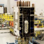
Harris Corporation has provided Lockheed Martin with its sixth of 10 advanced navigation payloads contracted for the U.S. Air Force’s GPS III satellite program, the company announced today.

The GPS III navigation payload features a Mission Data Unit (MDU) with a unique 70-percent digital design that links atomic clocks, radiation-hardened processors and powerful transmitters – enabling signals three times more accurate than those on current GPS satellites. The payload also boosts signal power, which increases jamming resistance by eight times and helps extend the satellite’s lifespan.

Read More >

By Inside GNSS

Criminal Investigation Underway in GPS Jamming Incident That Crashed Drones, Caused HK$1M in Damage

More than 40 drones performing in a professionally organized light show fell from the sky in Hong Kong Saturday after the GPS signal they were using was jammed. The incident, which caused some HK$1 million in damage (U.S. $127,500), is now under criminal investigation.

The firm Sky Magic, which uses a customized fleet of performance dronesto do indoor and outdoor light shows, confirmed the incident but declined to discuss details of what happened because the investigation was still underway. The company, which has offices in the UK and Singapore, said it would provide more information once the investigation was concluded.

The unmanned aircraft were part of a 100-drone show that was cancelled after an outside party interfered with their operation, Asian news outlets reported. The light show was being performed in conjunction with the annual Hong Kong Wine & Dine Festival.The planned seven-minute show featured 100 rotorcraft with LED lights honoring the 10th anniversary of the festival by forming the outline of a birthday cake and the number 10.

The drones were lost during a show Saturday, October 27. Shows already had been done Thursday and Friday.

“After initial checks, the GPS signals for the drones were found to be interfered [with] by external parties and the board reported the issue to police immediately,” organizers said in a press release, according to the South China Morning Post.

“These are professional drones, which are already built with technologies that would direct them back to the takeoff origin,” Hong Kong Tourism Board’s Executive Director Anthony Lau told the Morning Post, “but the signals were so strong that many of them just dropped from the air.”

Lau said an initial police investigation ruled out the possibility that the machines had been hacked.

“They [the police] were here all night working with us, and our vendor, and looking into all sorts of possibilities, and have come to the conclusion that it is not computer hacking,” Lau said. “It is because someone jammed the GPS signal.”

By Inside GNSS

Imagination Technologies Introduces Comprehensive GNSS IP Core

Imagination Technologies today announced the offering of the Ensigma Location GNSS IP core that supports GPS, GLONASS, Galileo, and BeiDou as well as several Satellite-Based Augmentation Systems (SBAS) including WAAS and EGNOS. Designed for ultra-low power consumption, the IP is designed to optimize battery powered remote IoT sensors and edge devices, wearables, health monitors, consumer mobile products, automotive after-sales products such as insurance boxes and road tolling equipment, and asset tracking devices.

Read More >

By Stan Goff

Alliance of Automobile Manufacturers Opposes Ligado Frequency Plan

A proposed frequency change that could create interference with GPS receivers has picked up a new and powerful group of opponents. The Alliance of Automobile Manufacturers, which represents the country’s largest automobile makers and 70 percent of all the car and light truck sales in the U.S., filed a letter opposing a request by Ligado Networks (formerly LightSquared) to allow satellite-only frequencies near the satellite navigation band to also be used for terrestrial broadband services.

Read More >

By Dee Ann Divis
October 23, 2018

SDX 18.10 Now Available From Skydel

Skydel Solutions’ SDX 18.10, a new version of the company’s GNSS simulator that features improvements to receiver antenna management and a new advanced jammer type, is now available.

Starting with this SDX update is an upgraded paradigm for managing receiver antennas: SDX now supports the management of multiple vehicle antennas within a single scenario. Antennas can now be defined, named, and exported as antenna files that can be re-imported back into other scenarios. This handy feature will speed up antenna reuse and multi-scenario workflows for users managing numerous antenna models in GNSS simulation scenarios.

Read More >

By Inside GNSS
October 18, 2018

GPS Hackers Could Send Weapons to Wrong Target – GAO Report

A recent General Accountability Office (GAO) report is highly critical of the cyber security, or lack thereof, in U.S. weapons systems. One of the examples of cyber-attacks it lists is GPS spoofing.

The report, published this month, goes on to say:

“…weapon systems are dependent on external systems, such as positioning and navigation systems and command and control systems in order to carry out their missions—and their missions can be compromised by attacks on those other systems. A successful attack on one of the systems the weapon depends on can potentially limit the weapon’s effectiveness, prevent it from achieving its mission, or even cause physical damage and loss of life.”

Read More >

By Inside GNSS

International Navigation Conference 2018

The program for the Royal Institute of Navigation’s International Navigation Conference 2018 is now available online, but if you’re at this week’s ION GNSS+ conference in Miami, Fla., you can stop by Booth #516 for additional details.

Scheduled for November 12-15, 2018 at the Mercure Bristol Grand Hotel, Bristol, UK, INC 2018Navigation Challenges and Societal Benefits —is sure to provide attendees numerous benefits.

Read More >

By Inside GNSS

US to Acquire Thales’ Advanced Ground Segment Technology to Respond to Distress Signals

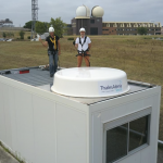
The National Oceanic and Atmospheric Administration (NOAA) in the United States, has chosen Thales to develop and build an operational ground station in the southwest part of the country, at Holloman Air Force Base in New Mexico, to track Global Navigation Satellite System (GNSS) satellites operating in medium Earth orbit (MEO).

The ground station will receive and process 406 megahertz distress beacon signals from the MEO satellites being tracked, and relay them to the US SARSAT (Search and Rescue Satellite Aided Tracking) program’s Mission Control Center (USMCC), via U.S. government communication links, for validation and distribution to rescue authorities, according to a Thales Alenia Space press release issued on Monday. This ground station will be designated the National Oceanic and Atmospheric Administration’s Southwest USA Medium-Earth Orbit Local User Terminal (SUSA MEOLUT), and will be an integral part of the MEO-based ground system operated by the USMCC.

SUSA MEOLUT will be working in conjunction with NOAA’s two operational MEOLUTs, located at the U.S. Coast Guard’s (USCG) COMMSTA stations in Honolulu and Miami. It is expected to be an operational part of the NOAA SARSAT system on a 24/7 basis. The MEO system, which provides distress alert and location data for search and rescue (SAR) authorities in near real-time, uses spacecraft and ground facilities to detect and locate signals from the 406 megahertz distress beacons.

By deploying Thales Alenia Space’s powerful and compact MEOLUT Next phased array solution, the United States will benefit from the world’s first spaceborne search and rescue system of this type. Thales Alenia Space, a Joint Venture between Thales (67 %) and Leonardo (33 %), designs, operates and delivers satellite-based systems for governments and institutions, helping them position and connect anyone or anything, everywhere. Since being commissioned in 2016, MEOLUT Next has delivered unrivaled performance, detecting distress signals from more than 5,000 kilometers away, according to Thales. Both France, Europe, Canada and Togo have already ordered Thales Alenia Space’s MEOLUT Next, and several more potential international customers are expected to announce their decisions shortly.

Related Reading: The Cospas-Sarsat MEOSAR System: A Solution to Support ICAO GADSS Autonomous Distress Tracking Recommendation 

“We are confident that our solution will meet and exceed NOAA SARSAT’s expectations, and provide decisive help to the UASA region,” said Philippe Blatt, Vice President, Navigation France at Thales Alenia Space, in the press release. “Today, MEOLUT Next is the only solution in the world capable of processing second-generation beacons in real time. Its operational efficiency was recently recognized by Space & Satellite Professionals International (SSPI) for its humanitarian contributions and the European Commission as well as governments of Togo and Canada have already selected this technology.”

This new capability saves lives. On July 2, 2017 at 6:30 a.m., 70 kilometers off the coast of Sardinia, a 12-meter sailboat with three people aboard triggered its Cospas-Sarsat beacon when its rudder broke and its engine failed. Its VHF radio out of range, the sailors quickly realized they were in a critical situation with waves over four meters high and the wind blowing at 40 knots. MEOLUT Next was able to receive and process their distress signals in less than five minutes, providing accurate positioning to authorities. An airplane identified the boat less than two hours after the beacon was triggered and a helicopter airlifted the crew to safety, saving all three lives.

MEOLUT Next
Conventional MEOLUT (Medium Earth Orbit Local User Terminal) systems use large parabolic antennas and are limited by how many satellite signals they can receive. Thales Alenia Space’s MEOLUT Next solution is compact, measuring less than six square meters, with the ability to track up to 30 satellites, significantly enhancing the distress beacon detection rate while expanding the coverage zone. Since there are no mechanical components, hardware maintenance costs are low, according to Thales.

By Inside GNSS
1 19 20 21 22 23 28
IGM_e-news_subscribe