GLONASS Archives - Page 3 of 4 - Inside GNSS - Global Navigation Satellite Systems Engineering, Policy, and Design

September 14, 2018

ION GNSS+ Slated for Sept. 24-28 in Miami

ION GNSS+, the world’s largest technical meeting and showcase of GNSS technology, products and services, will take place September 24-28, 2018 at the Hyatt Regency Miami in Miami, Florida.

This year’s conference will bring together international leaders in GNSS and related positioning, navigation and timing fields to present new research, introduce new technologies, discuss current policy, demonstrate products and exchange ideas.

Read More >

By Stan Goff
August 16, 2018

Nominations Being Taken for ION Fellows and Annual Awards

The Institute of Navigation (ION) has announced that nominations for ION Fellows and Annual Awards are now being accepted. The ION Annual Award Program recognizes individuals making significant contributions or demonstrating outstanding performance relating to the art and science of positioning, navigation and timing.

Read More >

By Inside GNSS
May 8, 2018

DT Research Introduces First Purpose-Built Rugged Tablet with Scientific-Grade GNSS

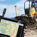
San Jose, California-based DT Research, a leading designer and manufacturer of purpose-built computing solutions for vertical markets, recently announced the DT301T Rugged RTK Tablet (DT301T-RTK), a lightweight military-grade tablet that is purpose-built for GIS mapping applications with real-time kinematic (RTK) satellite navigation used to enhance the precision of position data derived from satellite-based positioning systems. This tablet enables 3D Point Cloud creation with centimeter-level accuracy — meeting the high standards required for scientific-grade evidence in court.

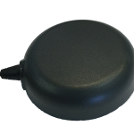
The DT301T-RTK is military-grade with an IP65 rating, yet lightweight — offering the versatility to be used in the field, office and vehicles. A dual frequency GNSS module is built into the tablet, which uses real-time reference points within 1- to 2-centimeter accuracy to position 3D point clouds created from aerial photogrammetry, using GPS, GLONASS and Galileo receivers. Users can measure with the RTK GNSS positioning directly using a foldable antenna or connect to an external antenna for more robust receiving and survey grade precision.

“We’ve seen a dramatic uptick in the need for rugged tablets to be purpose-built for a range of mapping uses across industries,” said Daw Tsai Sc.D., president of DT Research. “In designing the DT301T with RTK satellite navigation, we also took into consideration the other features and capabilities necessary within a rugged tablet to quickly and easily conduct forensic mapping, land surveying, e-construction, Building Information Modeling and other mapping scenarios.”

The DT301T-RTK tablet is compatible with existing GIS software for mapping applications and brings together the advanced workflow for GIS data capture, accurate positioning and data transmitting. The tablet can be used in a variety of scenarios, including:

Forensic Mapping — Public safety teams, investigators and crash reconstructionists can use the DT301T-RTK Tablet to accurately collect measurements that are scientifically defensible by using the real-time centimeter reference points to position 3D point clouds created from aerial photogrammetry or take stand-alone measurements, according to the company.

“When reconstructing a crime scene, crash scene or natural disaster — forensic mapping needs to have scientific-grade precision in order to stand up as evidence in court,” said Andrew S. Klane, a former Massachusetts State Police Lieutenant who teaches Forensic Mapping and is now the Chief Operating Officer at Forensic Mapping Solutions Inc. “As more drones are being used for mapping, there is a growing need for ground control positioning devices. By using a DT301T-RTK Tablet in combination with a drone, users can more quickly and cost-effectively create a 3D model to deliver an accurate representation of the scene with scientific-grade tolerance that will hold up in a court of law.”

The DT301T-RTK Tablet has been purpose-built for precision mapping in a variety of environments and includes the following features and capabilities:

  • Dual Frequency GNSS Module — GNSS L1 & L2 RTK that receives GPS, GLONASS and Galileo signals up to 372 channels with RMS 10 mm + 1ppm accuracy.
  • High Performance CPU and Windows OS — Intel® 6th Generation Core i5 or i7 processor with Microsoft Windows 7 Professional or Windows® 10 IoT Enterprise. Units come with either 8 GB or 16 GB of RAM.
  • Military Standards — For use in harsh environments, the tablet is fully ruggedized to meet the highest durability standards with an IP65 rating, MIL-STD-810G for vibration and shock resistance and MIL-STD-461F for EMI and EMC tolerance.
  • Accessories — The DT301T Rugged RTK Tablet is complemented by a variety of accessories, including: external antennas, pole mount cradles, detachable keyboards, battery charging kits, and digital pens.
By Inside GNSS
February 6, 2017

Criminal Liability Found in 2010 Explosion of Proton/GLONASS Satellites

Back in December of 2010, Inside GNSS reported that the loss of three GLONASS-M satellites in space resulted from a series of mistakes made by the Russian Energia rocket corporation. Now, more than six years later, Russian prosecutors have wrapped up a criminal case against four employees of Energia allegedly complicit in the crash of the Proton booster with three GLONASS satellites, and they’ve sent the case files to a court of law.

Read More >

By Inside GNSS
November 30, 2016

GPS, GLONASS, Galileo, and BeiDou for Mobile Devices

The navigation sensors for location-based services (LBS) are complex technical systems. Modern technical science can answer most questions about the optimality of particular position determination methods, signal processing algorithms, electronic circuits or similar well-defined problems, but the rigorous answer to the questions concerning the optimal LBS positioning sensor are still a big problem.

Read More >

By Inside GNSS
May 31, 2016

New GLONASS-M Survives Slight Glitch to Reach Orbit

Russia announced a successful launch of another GLONASS-M satellite on Sunday (May 29, 2016) despite an “irregularity” in the performance of the Fregat upper stage.

According to a report by the TASS state news agency, the Fregat operated longer than planned and used its engines to deliver the spacecraft safely into orbit. The Russian Defense Ministry’s press service reported earlier that a stable telemetry link had been established with the satellite and that onboard systems are functioning normally.

Read More >

By Inside GNSS
May 17, 2016

Russia Delays Launch of Next GLONASS Satellite

The Russian news agency TASS has reported that the launch of GLONASS-M satellite No. 53 from the Plesetsk cosmodrome has been rescheduled from May 21 to May 29, according to Reshetnev Information Satellite Systems CEO Nikolay Testoyedov.

The launch postponement has nothing to do with the satellite’s condition, Testoyedov said.

Russia’s State Space Corporation Roscosmos announced earlier that a Soyuz-2.1b carrier rocket was expected to bring a new Glonass-M satellite into orbit.

Read More >

By Inside GNSS
February 8, 2016

Russia Launches First GLONASS-M in More Than a Year

In its first GLONASS-M launch in more than a year, Russia lifted a satellite into orbit yesterday (3:21 a.m. Moscow time, February 7, 2016) from the Pletsetsk Cosmodrome, after being postponed from December.

GLONASS-M #51 (GLONASS constellation designation #751) will replace a 10-year-old satellite (GC#714) that ceased operations last October in slot 17, orbital plane 3 of the constellation.

Read More >

By Inside GNSS
IGM_e-news_subscribe