Japan’s Indoor MEssaging System (IMES) promises to provide “seamless” indoor and outdoor positioning with no extra hardware for a GPS-enabled phone, receiver, or other portable device. But what is it?
Japan’s Indoor MEssaging System (IMES) promises to provide “seamless” indoor and outdoor positioning with no extra hardware for a GPS-enabled phone, receiver, or other portable device. But what is it?
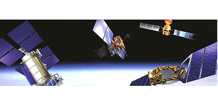
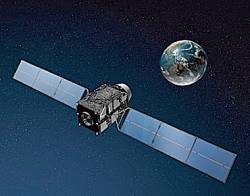
IMES is a lesser-known part of the regional Quasi-Zenith Satellite System (QZSS) being developed by the Japan Aerospace Exploration Agency (JAXA). The QZSS program will place three satellites in high-altitude orbits transmitting ranging signals to improve navigation performance in areas of Japan that prove difficult with GPS alone. The first launch of a QZSS satellite is scheduled for 2010.
Five of six QZSS signals transmitted from these satellites will use the same signal structures, frequencies, spreading code families, and data message formats as GPS and GPS satellite-based augmentation system (SBAS) signals.
An annex to the interface specification for QZSS (IS-QZSS) sets forth the IMES signal design. (See reference in Additional Resources section at the end of this article.)
Although QZSS satellite signals will only be available in a western Pacific Ocean region centered over Japan, IMES is a separate terrestrial element based on an open specification that could be implemented anywhere.
According to the annex, the IMES signal is designed by JAXA to contribute to “the development of QZSS-ready receivers as well as satellite positioning applications by realizing the seamless positioning environment.” However, IMES signal transmitters are not part of the QZSS component; rather, the IMES specification is intended to aid third-party vendors in further development and installation of the system.
Primarily, IMES is designed to provide accurate positioning indoors where reception of GPS and other GNSS signals is blocked or unreliable. By being able to operate indoors using GPS-capable equipment (by upgrading a receiver firmware with the IMES navigation bit decoding algorithms), the system is meant to pick up where GPS fails, in a “seamless” way.
IMES is really competing with assisted-GPS or GNSS (AGPS/AGNSS), which has been used with some success — although substantial inaccuracy — for indoor positioning. In particular, its advocates advance IMES’s utility for enhanced 911 (E911) automatic location of emergency calls from mobile phone users.
At the recent International Symposium on GPS/GNSS in Tokyo, a number of technical presentations and exhibitors discussed the implementation of IMES technology by JAXA, GNSS Technologies (GNSST), and other companies. Hitachi and GNSST had receivers on their exhibit stands and graphics explaining how IMES worked.
For someone with a GPS background, these graphics were somewhat confusing. It looked as though IMES was a system of GPS retransmitters mounted to ceilings — something that wouldn’t help much at all for indoor navigation.
Further investigation, however, revealed that these transmitters, although they operate in the GPS L1 band, are in fact transmitting a completely separate signal. The IMES signal simply gives the location of the nearest transmitter, which an appropriately configured receiver can then take to be “its” position.
At this point, of course, the alarm bells go off. Transmitting in L1? To GPS users, that’s tantamount to jamming. So, is IMES the perfect answer to the “seamless” ubiquitous positioning problem – or is it a dangerous jamming threat to the integrity of GPS?
Perhaps the answer lies somewhere in between. . . . With that thought in mind, this article briefly describes the IMES program and raises several key issues about its practical use in combination with GNSSs.
The IMES Signal
In June 2008, JAXA released version 1.0 of the IS-QZSS document, which includes the IMES specification. The RF characteristics of IMES are the same as the L1 C/A code for GPS and QZSS.
Transmitted at the GPS L1 center frequency (1575.42 MHz), IMES has a bandwidth of 2.046 MHz or more including the main lobe. Like the L1 C/A code, the IMES signal is right-hand circularly polarized and BPSK-modulated with a pseudorandom noise (PRN) code.
In the current interface specification for GPS (IS-GPS-200D) the U.S. government has approved allocation of the Gold (or PRN) codes 173 to 182 for use by other GNSS applications such as IMES. The received power level at an IMES-capable receiver is specified to fall in the range between -158.5 dBW to – 94 dBW. Word structure, bit rate, and modulation are the same as L1 C/A code.
IMES Messages
IS-QZSS defines four different types of messages, as shown in Table 1 (above, right). Two messages give the location of the transmitter. Message type 0 gives the latitude (23 bits) and longitude (24 bits) in WGS-84. However, height or altitude appears as a building floor number (8 bits). Message 1 provides latitude (24 bits), longitude (25 bits), altitude (12 bits), and floor number (9 bits — with units of 0.5 floor).
Messages 3 and 4 simply send an identifier, which, according to GNSST, can then be used to address a location in a database corresponding to that ID. Messages 3 and 4 also transmit a “BD” bit, which is a border or boundary indicator, set whenever the transmitter is the one “nearest” the outdoors or a GPS-accessible area. (As yet undefined, Message type 2 is reserved for later development.)
IMES can be used by a suitably modified stand-alone GPS receiver but is primarily intended for use with a GPS-enabled mobile device. Notably, messages 3 and 4 rely on the device to be able to access a database via a network.
The Additional Resources section includes a number of articles, particularly those by D. Manandhar et alia, that describe IMES, its applications, and test results to date in greater detail.
What’s Good about IMES?
What IMES delivers that other indoor location systems does not is reliability and accuracy. When receiving an IMES signal, the receiver has a strong idea of where it is to within tens of meters. The accuracy is better than AGPS, especially in height, and receivers are not required to have high sensitivity.
The big selling point for IMES in Japan is its ability to add a lot of value to simple positioning with additional data, such as maps and route guidance. For example, locations extracted from the databases used with messages 3 and 4 can be accompanied by location-based service (LBS) information.
In fact, the location may not even be returned at all. The sorts of applications used by Hitachi and GNSST to promote or, in Australian slang, spruik IMES include indoor navigation, finding products in a store, geofencing of children, location-specific instructions in case of emergency, asset management, and so forth.
What’s Not So Good about It?
The technology is in its infancy; so, the list of problems that we will raise here looks large, but each issue needs to be dealt with if IMES is in fact going to succeed AGPS.
1. Infrastructure. For IMES to work, the transmitters need to be very densely located in all indoor spaces where location is required, at separations of 20–30 meters. This represents a massive investment in infrastructure. However, unlike AGPS, this investment does not necessarily need to be made by the telecom companies alone or even at all. Also, if the IMES infrastructure is incomplete, AGPS may still be required to fill the gaps.
2. Jamming. IMES should only affect a small area around the transmitter. However, within this area, IMES will completely jam GPS.
The QZSS specification suggests that the IMES power levels are high enough to jam GPS outdoors. A maximum transmitted signal strength of -94 dBW is about 65 dB stronger than an unobstructed GPS signal received outdoors. The receiver will generally receive the signal at a much lower level; the minimum is specified to be -158.5 dBW, but jamming is still likely to occur nearby to a transmitter. Indoors, where the direct GPS signals are strongly attenuated, the situation would be worse.
The Gold codes are designed so that a receiver should be able to detect a GPS signal that is about 21dB weaker than the strongest GPS signal. This is known as the cross-correlation margin. Advanced signal-processing techniques, such as those developed by Eamonn Glennon at the University of New South Wales, can increase this margin substantially, but even with indoor GPS, cross-correlation margins of 65 dB have not even been considered.
Other systems that have been assigned codes in the IS-GPS-200D, such as SBAS and QZSS itself, transmit at levels that do not exceed the cross-correlation margin. In practice, in Japan the levels will not be as high as those in the specification. GNSST suggest that transmitters will be limited to -100 dBW (or -70 dBm), still significantly stronger than GPS.
Initial GNSST experiments suggest that this transmitted signal strength only has a noticeable effect on a GPS receiver within one meter (with the stronger level of the specification affecting receivers out to three meters’ distance). These affected regions seem small, and independent tests should be used to confirm the GNSST results. If they are valid, IMES will only jam a relatively small area.
The system model of IMES is also not “backward compatible,” meaning that if a user has an AGPS device that has happily worked for years, once IMES is installed, that device can no longer use AGPS.
3. Seamlessness. Interestingly, in the papers presented about IMES, the word “seamless” appears prominently. The idea is that the same equipment can use GPS outdoors and IMES indoors, “seamlessly.” Some papers even claim that the seamlessness has been proven by experiment.
This isn’t quite the case, however.
Modified receivers and mobile phones have been shown to work indoors with IMES signals and outdoors with GPS, but as yet none of the published experiments appear to showing a receiver happily using IMES and transitioning without interruption to GPS outside, or vice versa. The transition from GPS to IMES should be “seamless” — that is, the receiver holds on to GPS until it is jammed or blocked indoors, by which time it has picked up IMES (as long as it is looking for it).
Going the other way is more problematic. IMES can be used until it is too weak to be received, but then the receiver should be able acquire four GPS satellites. If the equipment is being used in an environment broadcasting Messages 3 or 4, then it will have been warned by the BD bit to start looking for GPS signals. In a Message 1 or 2 environment, no such warning will have been given.
Because IMES requires the receiver to receive one IMES signal at a time, a “handover” between IMES transmitters must take place. So, while receiving from one transmitter, the receiver must be searching for others, not knowing which of the PRNs is best to search for.
The near-far phenomenon means that the current IMES transmitter will jam others until they are within the cross-correlation margin. Consequently, once a transmitter’s power has been set, maximum and minimum distances emerge for the placement of other transmitters.
These transmitters must use different PRNs or else they will spoof each other. This means that the IMES transmitters must be laid out based on a code-reuse pattern similar to the frequency-reuse patterns employed by cellular networks, with the added complication of operating in three dimensions, i.e., different floors of a building by definition have different IMES transmitters.
Returning to the question of GPS/IMES transitions, although a huge effect is not likely, this cross-acquisition between GPS and IMES will use more energy than for one system alone, if for no other reason than it increases the PRN search space by the 10 codes used for IMES.
4. “You are the ground segment.” The IMES transmitters, like GPS satellites, tell the receiver where they are. However, in the case of GPS satellites, a secure, centralized ground segment infrastructure is used to create the transmitted messages.
In the case of IMES, the lat/long/height/floor that is transmitted must come from somewhere else. Each of the locations must be surveyed in. The accuracy of this survey need not be great, because the resolution of the transmitted messages is 1–3 meters and, in any case, that position applies for regions of tens of meters.
However, the surveyed position of an IMES transmitter still needs to be accurate to, say, meters in WGS-84. Given the enormous numbers of transmitters needed for this system, a huge scope for error arises in a) the measurement of the position, b) the data entry of the position, and c) the installation of the equipment (a transmitter with a perfectly well entered position being installed in the wrong place).
5. “They are the ground segment.” Messages 3 and 4 don’t tell you your position directly. That information comes from a database. The business model put forward by GNSST suggests that the database may be owned by, “for instance, department store, underground mall and etc.”
What that means is that users may not get the position they’re looking for, just what the department store or underground mall wants them to receive. As with casinos in Las Vegas, navigating one’s way out of the shop as soon as possible may not be in the store owner’s best interest.
6. Security. Tens or hundreds of thousands of these devices are needed for IMES to operate properly. They will have to be installed in public areas such as shopping centers and railway stations, and private areas such as shops. Their installation needs to be cheap because of the sheer numbers involved.
However, if an IMES transmitter can be installed relatively simply, it is also likely to be easy to remove. A stolen transmitter, or one simply bought from the manufacturer, could cause havoc. Driving through a city with a high-powered IMES transmitter on the dashboard could cause all GPS navigators nearby to either cease working, or worse, if they are IMES-enabled, to think they were in the location of the stolen device (i.e., inside a building). It makes GPS jammers (or IMES spoofers) readily available to any small-time thief.
7. Frequency allocation and regulation. Ultimately, IMES will only ever operate in countries where the IMES signal has been sanctioned in the L1 band. This may in some cases require a change in the law before it can operate. In Australia, for instance, any transmission in the L1 band must not have an intention to jam GPS, otherwise it is considered a criminal act. IMES works by deliberately jamming GPS (or at least AGPS) in indoor environments.
Although IMES transmitters are not pseudolites, it would make sense if they were regulated in a similar way. Recently, the European Conference of Postal and Telecommunications Unions (CEPT) has taken the lead in trying to come up with a global standard for pseudolite regulation. The relevant committee is yet to report (possibly early in 2009).
Conclusion
In summary, it appears that before IMES can make significant inroads into indoor positioning, a series of hurdles must first be overcome. IMES is not a magic bullet for the current hot problem of ubiquitous or “seamless” positioning. It’s just another option to add to the list, with its own set of strengths and weaknesses.
Additional Resources
Japan Aerospace Exploration Agency, Quasi-Zenith Satellite System Navigation Service Interface Specification for QZSS (IS-QZSS) V1.0, June 17, 2008 (available on-line at <http://qzss.jaxa.jp/is-qzss/index_e.html>)
NAVSTAR Global Positioning System Interface Specification IS-GPS-200, Revision D, IRN-200D-001, Navstar GPS Space Segment/Navigation User Interfaces, GPS Wing, Space and Missile Systems Center, Los Angeles AFB, California, USA, March 7, 2006
Glennon, E., and R. Bryant, A. Dempster, and P. Mumford, “Post Correlation CWI and Cross Correlation Mitigation Using Delayed PIC,” Proceedings of ION GNSS 2007, Fort Worth, Texas, US, September 26-28, 2007
Manandhar, D., and K. Okano, M. Ishii, M. Asako, H. Torimoto, S. Kogure, and H. Maeda, “Signal Definition of QZSS IMES and Its Analysis,” Proceedings of ION GNSS 2008, Savannah, Georgia, USA, September 16–19, 2008
Manandhar, D., and K. Okano, M. Ishii, M. Asako, H. Torimoto, S. Kogure, and H. Maeda, “Development of Ultimate Seamless Positioning System for Global Cellular Phone Platform Based on QZSS IMES,” Proceedings of ION GNSS 2008, Savannah, Georgia, USA, September 16–19, 2008
Manandhar, D., and S/ Kawaguchi, M. Uchida, M. Ishii, and H. Torimoto, “IMES for Mobile Users: Social Implementation and Experiments based on Existing Cellular Phones for Seamless Positioning”, Proceedings of International Symposium on GPS/GNSS, Tokyo, November 11–14, 2008
Martin, S., and H. Kuhlen, and T. Abt, “Interference and Regulatory Aspects of GNSS Pseudolites,” Journal of Global Positioning Systems, vol. 6, no. 2, pp. 98-107, 2007


