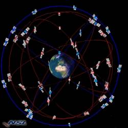
 Combined GPS + Galileo constellation. Image source: Nottingham Scientific Ltd., UK
Experts working on standards for airborne equipment using GPS, Galileo, and a satellite-based augmentation system (SBAS) appear to have found a way to deal with an unusual problem — too many satellites.
Experts working on standards for airborne equipment using GPS, Galileo, and a satellite-based augmentation system (SBAS) appear to have found a way to deal with an unusual problem — too many satellites.
With a number of SBAS systems and four global satellite navigation constellations either already operating or under development, eventually "many, many satellites” will be in view, said the satnav experts of RTCA’s Special Committee 159 (SC-159) on GPS. So many, in fact, that incorporating them all into a navigation solution may be more that the processors in GNSS equipment can handle.
During the October 21 plenary meeting of RTCA, however, Working Group 2 (WG-2) of SC-159 reported on a promising solution to the problem developed by Todd Walter, senior research engineer at the Stanford GPS Lab at California’s Stanford University.
Walter’s approach, which will be described in more detail in an article in an upcoming issue of Inside GNSS, chooses the optimum combination of satellites to get the best performance. Although that sounds simple, arriving at such a solution requires first answering questions like what constitutes “best performance” and what yardstick do you use to first select satellites then compute and evaluate a navigation solution — all while using processor capacity efficiently.
To tackle the problem Walter suggested and compared several approaches for the working group during an exercise to select the best 20 satellites out of 30 satellites in view.
One of the simpler options was to drop those satellites at the lowest elevations. Another approach called the used a “greedy algorithm” based on making a locally optimum choice, or prune, and at each stage — a technique that should result in a convergence to a global optimum. The Greedy Method process involved calculating all subsets, removing one spacecraft at a time. Remove from consideration the result (and thereby one satellite) with the smallest impact on a chosen performance criterion, such as geometric dilution of precision (GDOP), Walter explained. Keep down-selecting until you get to the number of satellites you want to work with.
Walter then modified the Greedy Method to look for the smallest solution variance after satellite removal.
“Start with an all-in-view covariance matrix,” the working group chairs said in their summary, “remove one satellite at a time by ‘adjusting’ the full solution variance without a full subset computation — this is the “measurement downdate.” This approach uses a focus on obtaining the smallest position variance to cut the amount of computation required by the original Greedy Method.
Walter proposed a further refinement called the Heuristic Optimal Criterion, which uses a weighed combination of horizontal protection level (HPL) and vertical protection level (VPL) variance to better balance the selection between horizontal and vertical covariance optimums — with a bias in favor of VPL.
The method offered by Walter, concluded the WG-2 “will become an important, possible solution to subset satellite selection as the sky fills with satellites.”
Though heuristic, they said, his approach “will become at least a reference technique if not a minimum requirement in the eventual DFMA/MCMF MOPS,” that is the minimum operational performance standard (MOPS) for dual-frequency, multi-constellation (DFMA)/multi-constellation, multi-frequency (MCMF) equipment.
“Not bad at all,” the working group concluded.


