 One of 12 magnetograms recorded at Greenwich Observatory during the Great Geomagnetic Storm of 1859
 1996 soccer game in the Midwest, (Rick Dikeman image)
 Nouméa ground station after the flood
 A pencil and a coffee cup show the size of NASA’s teeny tiny PhoneSat
 Bonus Hotspot: Naro Tartaruga AUV
 Pacific lamprey spawning (photo by Jeremy Monroe, Fresh Waters Illustrated)
 “Return of the Bucentaurn to the Molo on Ascension Day”, by (Giovanni Antonio Canal) Canaletto
 The U.S. Naval Observatory Alternate Master Clock at 2nd Space Operations Squadron, Schriever AFB in Colorado. This photo was taken in January, 2006 during the addition of a leap second. The USNO master clocks control GPS timing. They are accurate to within one second every 20 million years (Satellites are so picky! Humans, on the other hand, just want to know if we’re too late for lunch) USAF photo by A1C Jason Ridder.
  Detail of Compass/ BeiDou2 system diagram
 Hotspot 6: Beluga A300 600ST

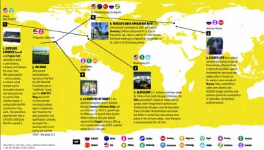
1. CONFERENCE
√ Solar physicists met in Ethiopia in November for the Africa Space Weather Workshop. They had been monitoring the origin of coronal mass ejections – plumes of electrified gas – focusing on the geomagnetic equator, which passes over the sub-Sahara. With only a few dozen GPS geodetic receivers in Africa, conference organizers are trying to interest researchers in setting up hundreds more. They hope to be making real-time maps of the ionosphere over Africa within five years. Find out more about space weather and GNSS in this issue’s cover story.
2. GOVERNMENT ACTION
√ Iceland’s Ministry of Transport, Europe’s 112 Emergency Service, and New Development, a company that specializes in vehicle tracking systems, will establish a satellite monitoring system for vehicles in Iceland, according to a November 14 story in Iceland Review Online. The Icelandic Automobile Association’s managing director said that people have had mixed reactions to the proposed system – but time and location information will only be provided if the car is in an accident. Will the system be mandatory? How soon? These details have not been announced.
3. BRIGHT IDEA
√ Highly sensitive GPS stations placed on mountain bedrock underneath Greenland’s inland ice show that the landmass is rising up to 4 centimeters a year, according to the Danish National Space Center (DTU) in Copenhagen. Senior research Shfaqat Kahn said on October 11 that his team has been monitoring data from these stations since 2001. They found that the southeastern tip of Greenland is rising upwards. The rate has dramatically increased in recent years. The cause? Melt water from global warming speeds the flow of glaciers to the sea, where they break off and lighten the load on the landmass.
4. LAUNCH
√ Russia puts three GLONASS-M satellites into orbit.
5. BRIGHT IDEA
√ The moai – massive statues for which Easter Island is famous – are about to appear in 3-D, along with everything else on the world’s most isolated inhabited island. An international team is working with local officials and archaeologists to create a model of artifacts, infrastructure, and natural resources that will become an analysis tool for sustainable development.

 opens up December meeting to exhibitors, sponsors, observers")
