Aerospace and Defense Archives - Page 33 of 53 - Inside GNSS - Global Navigation Satellite Systems Engineering, Policy, and Design

Aerospace and Defense

May 14, 2015

USAF Draft RFP Would Re-Open Competition for GPS Satellite Launch Services

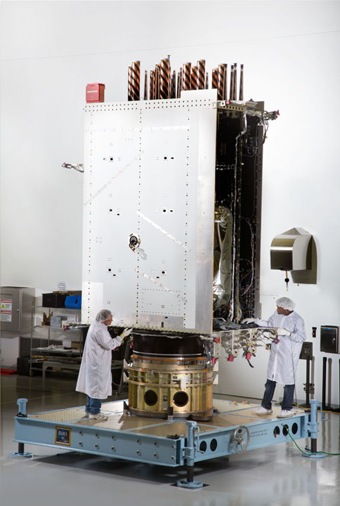
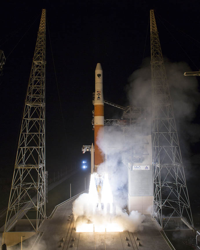
GPS Block IIF-5 on its way from Cape Canaveral on February 20, 2014. Photo by Ben Cooper, United Launch Alliance

[Updated May 26, 2015] The U.S. Air Force released a draft request for proposal (RFP) yesterday (May 13, 2015) for GPS III Launch Services, including launch vehicle production, mission integration, and launch operations. The Space Exploration Technologies Corporation — better known as SpaceX and headed by Elon Musk — may well enter the competition.

Read More >

By Inside GNSS
May 6, 2015

Lockheed Completes Integration of First GPS III Spacecraft

In April, Lockheed Martin fully integrated the U.S. Air Force’s first next-generation GPS III satellite at the company’s Denver, Colorado–area satellite manufacturing facility. The first in a design block of new, more powerful and accurate GPS satellites, GPS III Space Vehicle One is now preparing for system-level testing this summer. Lockheed Martin photo

Lockheed Martin has finally been able to announce victory in its effort to complete integration of the first GPS Block III satellite.

Integration took place last month at the company’s GPS III Processing Facility near Denver, Colorado, bringing together the system module — which includes the navigation payload that performs the primary positioning, navigation, and timing mission — the functional bus containing the electronics that manage all satellite operations, and the propulsion core that enables the satellite to maneuver for operations on orbit.

Read More >

By Inside GNSS
[uam_ad id="183541"]
April 21, 2015

FAA Awards New GPS WAAS Contract to Raytheon

The Federal Aviation Administration (FAA) has awarded a $103-million contract to the Raytheon Company to maintain the GPS Wide Area Augmentation System (WAAS).

The company will develop a payload to be incorporated into a new geostationary satellite and two associated ground uplink stations to support the WAAS system within U.S. airspace. WAAS improves real-time GPS accuracy from 10 meters to about two meters by transmitting differential corrections as well as integrity messages and an additional ranging signal.

Read More >

By Inside GNSS
March 25, 2015

Cutting Edge Applications of Unmanned Systems

The incorporation of GNSS and inertial technologies is helping drive an explosion of systems development and applications of unmanned systems. On Tuesday, September 29, Inside GNSS and NovAtel presented a 90-minute web seminar showcasing some of these applications, including the use of remote sensing technologies to assess pest populations in commercial crops and to conduct infrastructure inspections, with the aid of air and ground vehicles.

Read More >

By Inside GNSS
March 18, 2015

GAO Report: More Delays, Cost Increases for OCX, GPS III

New delays and higher costs should be expected for both the GPS III satellite program and GPS-OCX, the new GPS ground system, federal watchdogs warned in a new report.

The Government Accountability Office (GAO) said both programs are in the process of rebaselining, that is, resetting their estimated schedules and costs. In the case of the Next Generation Operational Control System (GPS OCX), which is essential for full operation of the new GPS III satellites, the changes could be significant.

Read More >

By Inside GNSS
[uam_ad id="183541"]
March 14, 2015

Seriously Seeking a Galileo Service Operator

Carlo des Dorides, El?bieta Bie?kowska

Last January, the European GNSS Agency (GSA) announced a new invitation to tender for the role of Galileo service operator (GSOp). Speaking at the recent EU Space Policy Conference in Brussels, GSA Executive Director Carlo des Dorides called it the largest contract ever to be awarded under the Galileo program.

“It will shape the future of Galileo,” he said.

Read More >

By Peter Gutierrez

Expanding EGNOS Horizons

GPS+EGNOS tracking device able to use EGNOS OS and EDAS mounted on a container

The European Geostationary Navigation Overlay Service (EGNOS) has a European regional coverage that could be extended quite easily to areas adjacent to the European Union. Backed by the European Commission, a public/private consortium is operating programs of technical assistance to prepare nations in the Mediterranean region to adopt and exploit European GNSS services in their priority market segments, namely aviation and road freight transport/logistics.

Read More >

By Inside GNSS
January 19, 2015

Galileo Upgrade Will Cause Temporary Decline in Service

Galileo Sensor Stations (GSSs) pick up Galileo signals in space (SIS) to perform clock synchronisation and orbit measurements which are fed back to the twin Galileo Control Centres to serve as the basis of the navigation message incorporating clock and position corrections and associated integrity data. Uplink Stations (ULSs) then uplink this navigation message to the Galileo satellite navigation payloads for rebroadcast to users. Telemetry, Tracking and Command Stations (TT&Cs) provide the link between the Control Centres and the satellite platforms. ESA figure

Galileo’s operation controllers will temporarily stop updating satellite orbital positions in the system’s navigation messages beginning near the end of this month in order to help implement upgrades in the ground mission segment, the European Space Agency (ESA) announced today (January 19, 2015).

Although the Galileo satellites will continue to transmit navigation signals, the generation and uplink of updated navigation messages will be interrupted during the last week of January for about five weeks.

Read More >

By Inside GNSS
1 31 32 33 34 35 53
IGM_e-news_subscribe