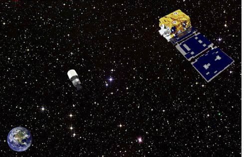
 Artist representation of ANGELS observing the AFSPC-4 Delta-4 upper stage several hundred kilometers above GEO. AFRL illustration
While the GNSS community waits for the scheduled launch on Friday (August 1, 2014) of the seventh GPS Block IIF satellite, the United Launch Alliance successfully lifted a three-satellite Air Force Space Command (AFSPC) payload into geosynchronous orbit on Monday (July 28, 2014) from Cape Canaveral Air Force Station, Florida.
While the GNSS community waits for the scheduled launch on Friday (August 1, 2014) of the seventh GPS Block IIF satellite, the United Launch Alliance successfully lifted a three-satellite Air Force Space Command (AFSPC) payload into geosynchronous orbit on Monday (July 28, 2014) from Cape Canaveral Air Force Station, Florida.
The latter mission includes two satellites for the Geosynchronous Space Situational Awareness Program, or GSSAP, and the Automated Navigation and Guidance Experiment for Local Space (ANGELS) satellite, managed by the Air Force Research Laboratory (AFRL) Space Vehicles Directorate, located at Kirtland Air Force Base, New Mexico. The ANGELS navigation payload includes a GPS receivers designed for operation in an orbit high above the middle Earth orbit of GNSS spacecraft.
As part of AFRL’s research in advanced space situational awareness (SSA), the ANGELS program will examine techniques for providing a clearer picture of the environment around vital U.S. space assets. During its planned one-year mission life, ANGELS will test several new spacecraft technologies and operations methodologies.
The spacecraft hosts an SSA sensor payload to evaluate techniques for detection, tracking, and characterization of space objects as well as attribution of actions in space. ANGELS will evaluate these SSA techniques in a limited region around the second stage of the Delta IV rocket that carried the satellites into space, testing maneuvering concepts several hundred kilometers above geosynchronous Earth orbit (GEO).
The GPS system uses advanced algorithms from NASA to receive GPS side lobe signals and generate near-continuous navigation solutions, according to the Air Force. High-performance accelerometers are also on board to precisely measure small spacecraft accelerations for enhanced guidance and navigation. An experimental vehicle safety system will explore methods for reducing the probability of collision with other space objects in an increasingly congested space environment
The GSSAP satellites will provide a space-based capability operating in the near-GEO orbit regime supporting U.S. Strategic Command’s space surveillance operations as a dedicated space surveillance network, or SSN, sensor. They will collect space situational awareness data allowing for more accurate tracking and characterization of man-made orbiting objects.
The GSSAP spacecraft will offer a clear, unobstructed, and distinct vantage point for viewing resident space objects orbiting earth in a near-geosynchronous orbit without the disruption of weather or atmosphere that can limit ground-based systems.
According to the Air Force, data from GSSAP is expected to contribute to timely and accurate orbital predictions, enhancing knowledge of the geosynchronous orbit environment, and further enabling space flight safety to include satellite collision avoidance.
GSSAP satellites will communicate information through the worldwide Air Force Satellite Control Network ground stations, then to Schriever Air Force Base, Colorado, where satellite operators of the1st Space Operations Squadron, 50th Space Wing, will oversee day-to-day command and control operations.


